
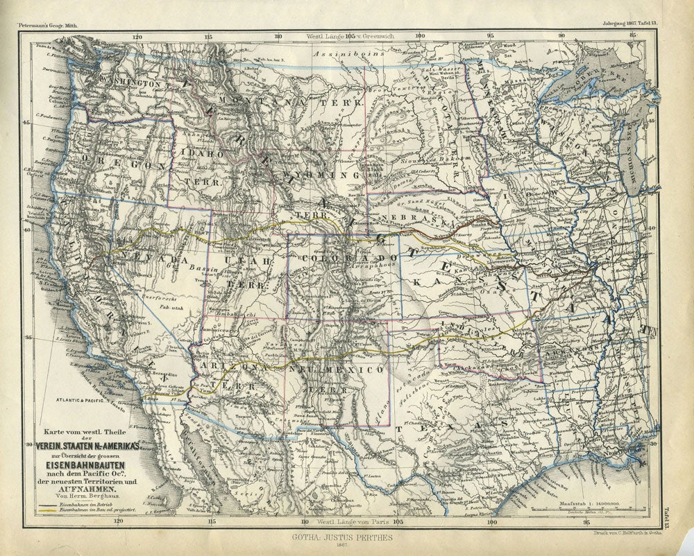
Verein. Staaten N.-Amerika's, zur ubersicht Eisenbahnbauten nach dem Pacific Ocn. der neuesten Territorien und Aufnahmen. Map.
Gotha: Justus Perthes, 1867. German map of the western United States, showing more territories than states to the west of the Mississippi River, as well as the Union Pacific's projected route, as the map was made during the first transcontinental railroad's construction. Showing Montana Territory, Dacota (sic) Territory, Wyoming Territory, Idaho Territory, Indian Territory, New Mexico Territory, Arizona Territory and Utah Territory. Nebraska had just been designated a state in March of 1867; it is shown here as a state.
The map shows operational rail lines as well as proposed lines, including the Union Pacific, and its main competitor, the Central Pacific during the post Civil War years in which railroad construction greatly accelerated. Between 1865 and 1869 the Union Pacific laid 1,087 miles of track, and the Central Pacific laid 690. Each mile of track was subsidized by the federal government by more than $16,000, so there was a great incentive to lay track quickly.
The cartographer is Hermann Berghaus, cartographer in the Geographical Institute of Justus Perthes at Gotha. His best known work is a chart of the world which went through many additions. Outline hand color. 10 3/4 x 9". Small chip at lower right margin, not affecting map. Very good condition. Item #24013
Price: $225.00