
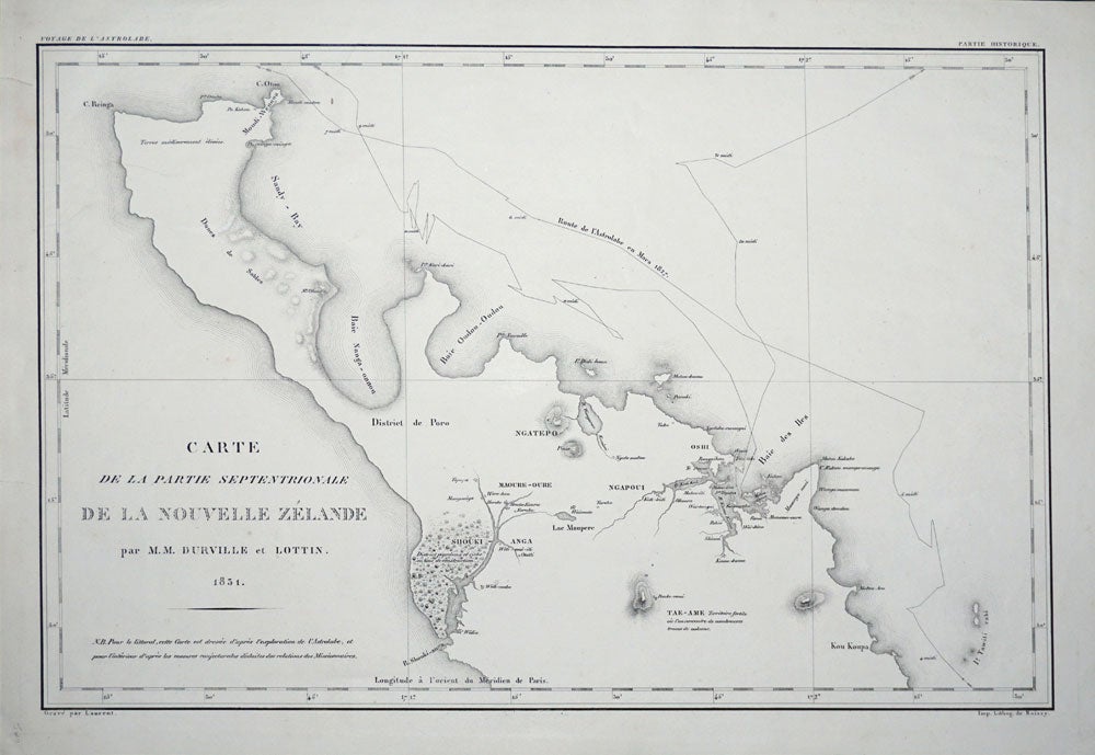
Carte de la Partie Septentrionale De La Nouvelle Zelande par M.M. Durville et Lottin 1831.
Paris: 1831. First printing. A copper engraved map of the North Island and part of the South Island of New Zealand by Dumont d'Urville and Lieutenant Victor Lottin, aboard the ship the Astrolabe during the first D'Urville voyage to the South Seas, 1826 - 1829. The chart shows the 1827 track of the Astrolabe from Hauraki Gulf. D'Urville proceeded to North Cape and then to the Bay of Islands (shown on the map), leaving New Zealand in March 1827.
Copper engraving by Alphonse Chassant, 1808-1907 and published in the 1836 edition of Dumont d'Urvilles "Voyage de la corvette L Astrolabe: exécuté par ordre du roi, pendant les années 1826-1827-1828-1829......"
18 1/8 x 12" with margins, with a central fold, as usual. Two small closed tears in left margin, otherwise very good condition. Item #24304
Price: $1,000.00