
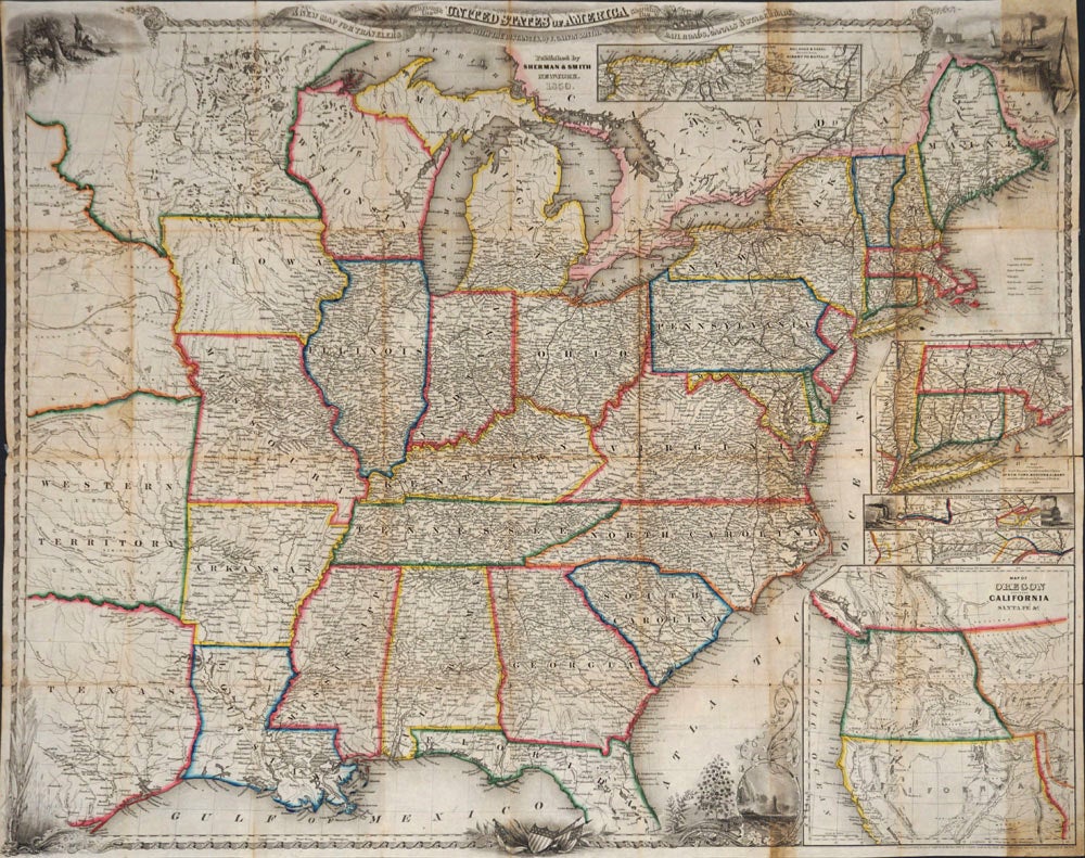
A New Map for Travelers Through the United States of America Showing the Railroads, Canals & Stage Roads. Map.
New York: Sherman & Smith, 1850. Lithographed and original hand colored map of the central and eastern United States, with an inset of California and Oregon and a focus on transportation throughout the states.
Four other inset maps focus on transportation:
1. Railroads & canal routes from Albany to Buffalo.
2. Map showing the rail roads between the cities of New York, Boston & Albany and the Hudson R. from N. York to Albany.
3. Rail road route from New York to Philadelphia.
4. Rail road route from Philadelphia to Washington
At the west, showing Texas, and north of it, Western Territory and Nebraska, so that with the California and Oregon inset map the US is shown from shore to shore. Vignettes in the upper corner of the main map show Native Americans, sailing and steam ships, canals and railroads.
27 x 21 1/4". Short split at folds at right edge, with no loss; slight browning at folds. OCLC: 923023599. Very good - condition. Item #24722
Sold