
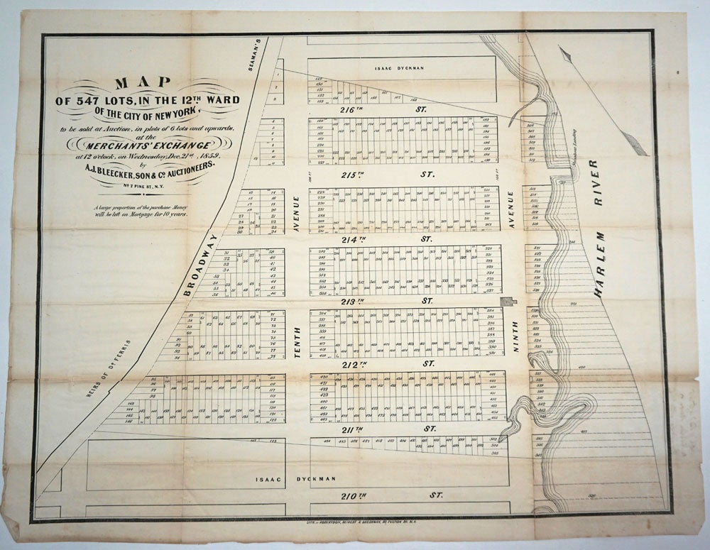
"Map of 547 Lots, in the 12th Ward of the City of New York, to be sold at Auction ... at the Merchants' Exchange, .. Dec. 21st, 1859". Land subdivision in Manhattan.
New York: Seibert & Sherman, 1859. Lithographed auction plan of lots for sale in Inwood, the northeastern tip of Manhattan, showing land subdivision in the use of the grid system for lots applied to not yet existing land, in other words, on land that would have to be created from landfill in the Harlem River.
The commissioners of New York had terminated the use of the grid system at 155th Street in order to prevent speculation on unbuildable land. The grid system of the day created a standard block of 800 by 200 ft, divided into lots of 25 by 100 feet, yielding 64 lots per block. This meant that the auctioned blocks shown on the plan east of ninth Avenue (lots numbered 506 to 547) would have to be created through the use of landfill. Much of that area, from 215th Street south, is currently a train yard.
Exending the shoreline to create more buildable land had been in practice since the 1700s. Lower Manhattan had already become too congested and the harbor too small for the volume of trade at the time, so the city, as well as private individuals, began to deliberately extend the shoreline farther out into the Hudson River by filling in with dirt and refuse.
The plan shows lots located just southeast of present day Columbia's playing field, between Broadway ("heirs of Dr. Ferris" and "Seaman's" to the west) and Ninth Avenue, and from 211th ("Isaac Dyckman" land to the south) up to 216th Street ("Isaac Dyckman" to the north).
28 x 21 1/2". Few splits at intersections, some light browning on folds. Not recorded in WorldCat. Very good condition. Item #24723
Price: $750.00