


Map of the American Colonies, bound in The Annual Register, or a View of the History, Politics, and Literature, For the Year 1763.
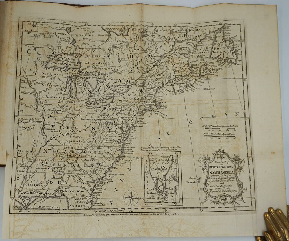
London: J. Dodsley, 1763. Fourth editon, published in 1776. Hardcover. A yearly volume from the British series on historical, political, and literary papers of the preceding year, with important folding map of the American colonies engraved by Thomas Kitchin, 'A New Map of The British Dominions in North America with the limits of the Governments annexed thereto by the late Treaty of Peace and settled by Proclamation October 7th 1763'. Obviously the British public of the time had a strong desire to know more about the American colonies, having just experienced the Revolutionary War.
The folding map accompanies the article pertaining to the American colonies titled, "State of our conquests in North America..." (pp 18 -32), continued, pp 208 - 213. The map (with inset of East Florida) indicates the colonies which remained at the end of the French and Indian Wars, showing the southern colonies as far west as the Mississippi and numerous Indian tribes. Maps with good impressions.
8vo, [ii], 216 pp; 307 pp, [v] Contents, 4 folding maps at rear. Full tan calf, spine sunned, worn and cracked with darkening, cracked at edge of spine, boards rubbed, front board detached but present. The armorial bookplate of Thomas Chauntrell at the front paste down. Externally needs work, internally clean. As is. Good condition. Item #24848
Price: $450.00