
Map of Brisbane Compiled and Lithographed from Official Maps.
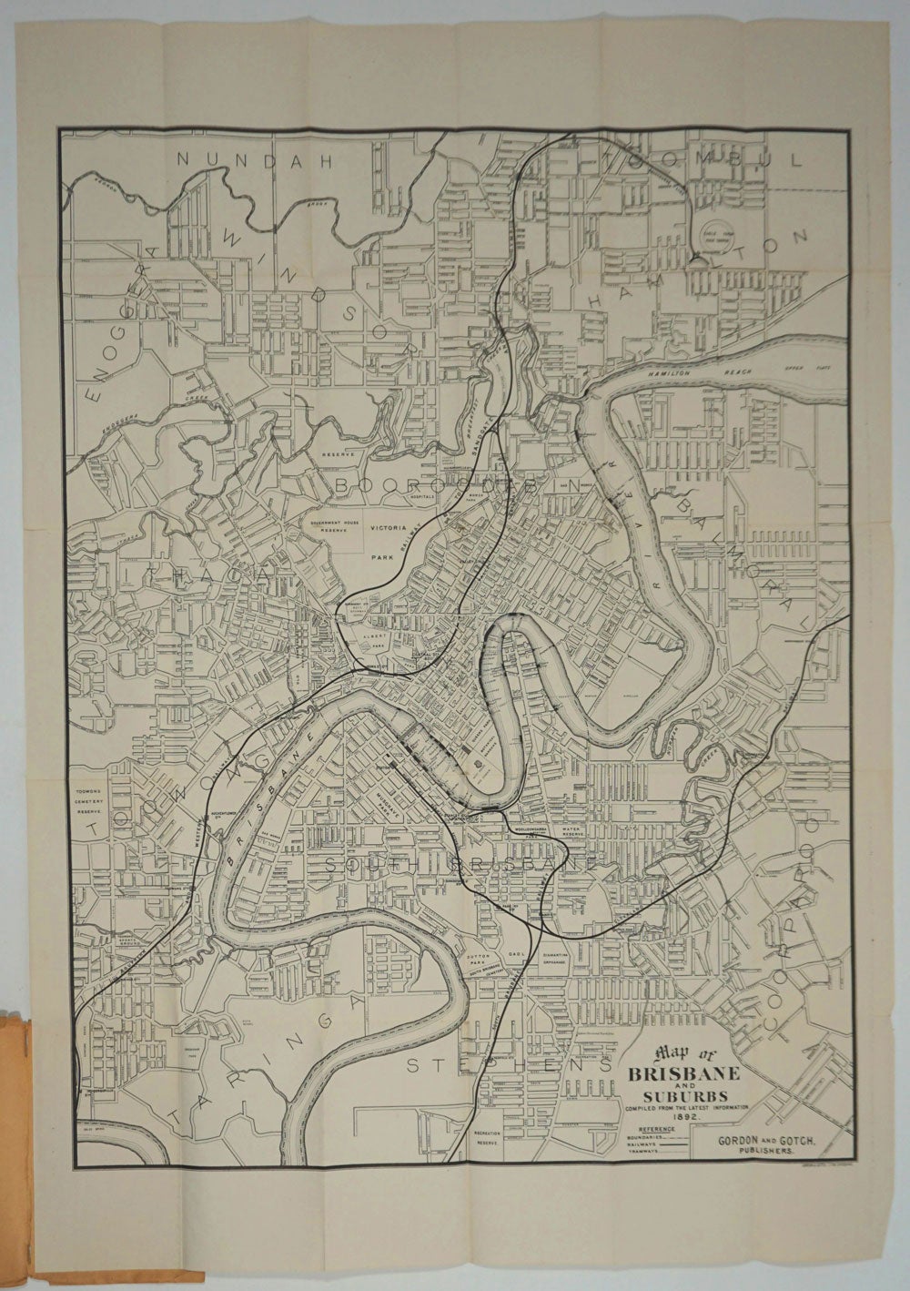
Brisbane: Gordon and Gotch, 1892. Large folding lithographed map of Brisbane and suburbs, covering the area south to Taringa and Stephens, north to Kedron and Nundah (part), west to Toowong, east to Coorparoo and Balmoral.
Shows street names, boundaries, suburbs, railways, tramways and ferries. Railways include the Southern and Western Railway, the South Brisbane, Cleveland, Sandgate and Gympie and the Racecourse Line.
Folding map, 25 x 35 1/2". In the original printed paper wrappers. Slight ruffling of wrapper edges. Map in very good condition. Trove 27793996 records only a 1912 edition. Very good condition. Item #24953
Sold
See all items by Queensland