
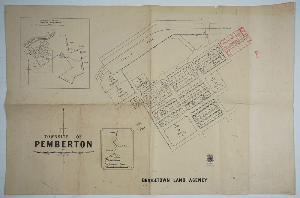
Townsite of Pemberton. Bridgetown Land Agency.
Perth: Department of Lands and Surveys, 1933. Cadastral map showing land use. Includes plan showing townsite boundary. Version dated "6.2.33". Addition of lots 185-200 on upper right to town plan printed in red.
The earliest held by SLWA seems to be [ca. 1950]. Call Number 9024.P3G46
1 map ; 58 x 76 cm., encapsulated in plastic.
Western Australia. Department of Lands and Surveys.
Map | Dept. of Lands & Surveys W.A. | 1937.
Available at 3rd Floor Map Stack (Call number: 35/11/MANJ (1937)) plus 1 more.
Call Number
9024.M25G46
Related titles
Townsite maps, Western Australia.
Description
1 map ; 54 x 69 cm., encapsulated in plastic.
Part of collection: Townsite maps, Western Australia. Item #25852
Price: $250.00