
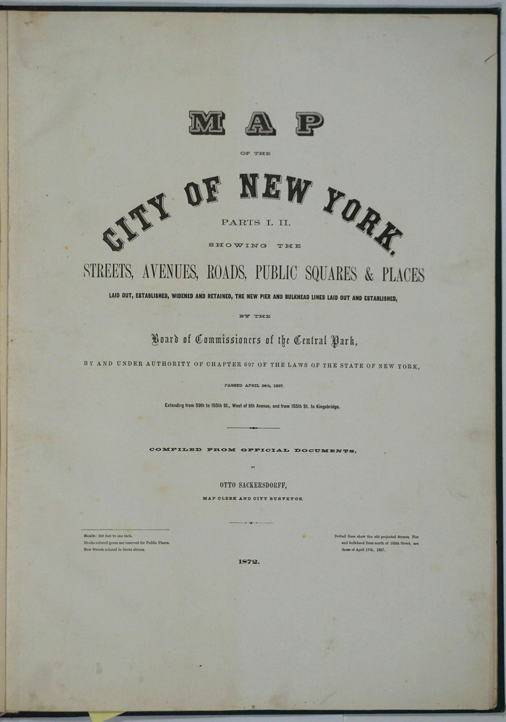

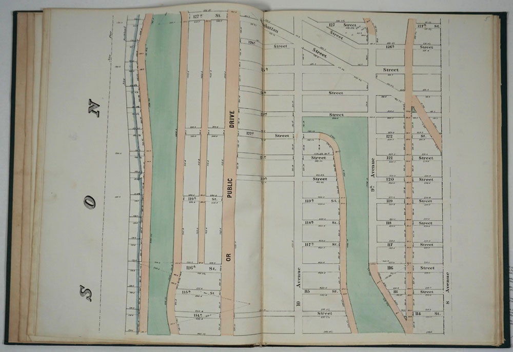
Map of the City of New York. Parts I & II. Showing the Streets, Avenues, Roads, Public Squares & Places Laid Out, Established, Widened and Retained, the New Pier and Bulkhead Lines Laid Out and Established, by the Board of Commissioners of the Central Park. Atlas.
New York: 1872. Hardcover. Maps of Manhattan's west side, prior to the completion of Central Park, which was finished in 1876. The maps were compiled by longtime New York City Department of Public Works map clerk and city surveyor Otto Sackersdorff, noted for his 'Maps of Farms, Commonly called The Blue Book, 1815". The Blue Book was not published until 1868, as a demonstration of northern economic might at the end of the Civil War.
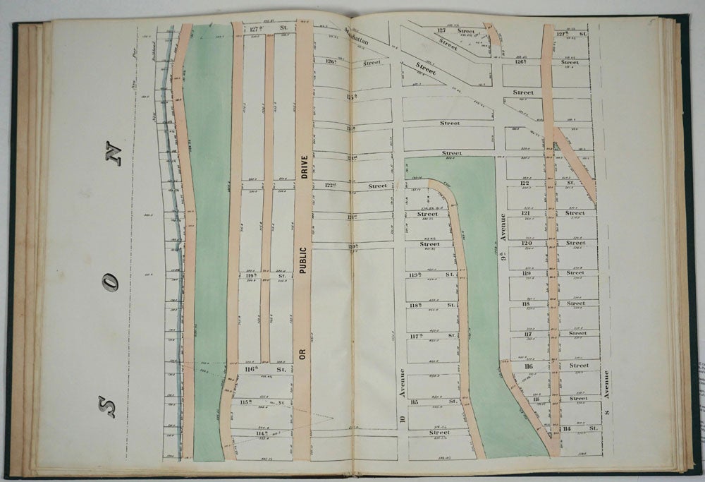
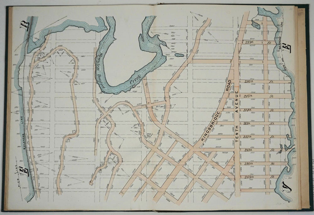
The real estate maps show property lines, existing roads, parks, shorelines, wetlands, and the Manhattan grid, extending from west of 8th Avenue at 59th Street and Columbus Circle up to 222nd Street and Spuyten Duyvil & Kingsbridge. Parks and major thoroughfares include: Central Park, St. Nicholas Avenue, Fort Washington Park, Kingsbridge Road, and High Bridge Park.
Folio, 15 x 20 1/2", 14 maps in total: 1 full page and 13 double page (28 x 20") hand colored lithographed map sheets. Each map contiguous with one another. Period quarter green gilt leather and dark green buckram boards. Spine gently rubbed; the maps exceptionally bright and clean.
Previous owner inscription, in pencil, E. B. Van Winkle from Chas. H. Myers, July 1875. Van Winkle was a civil engineer with an interest in road construction and drainage, having written a report on the drainage of the 23rd & 24th wards of New York City. Myers was an Assistant Engineer in Charge of Sewers for New York City.
OCLC: 41175506 at Princeton and OCLC: 40671892 at Columbia and the New York Public Library. Very good + condition. Item #26020
Price: $3,500.00