
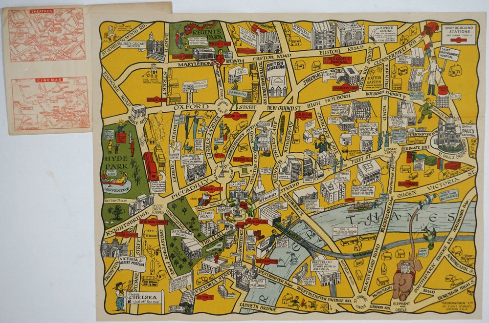
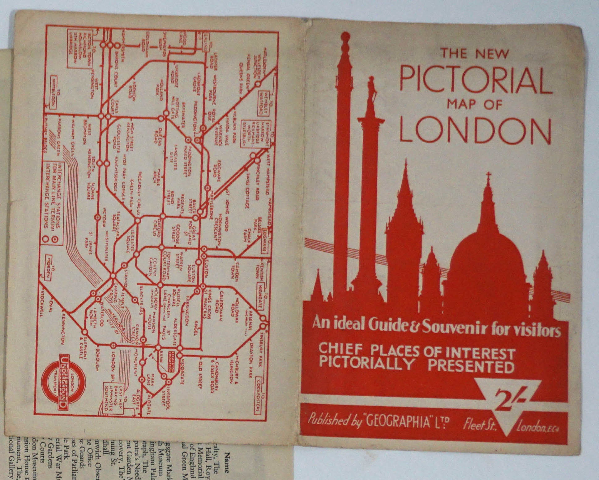
The New Pictorial Map of London. An Ideal Guide & Souvenir for visitors. Chief Places of Interest Pictorially Presented.
London: Geographia, Nd, Ca. 1930. Color pictorial souvenir map of London, with amusing cartoon illustrations and comments in speech bubbles, extending from the Victoria & Albert Museum and Hyde Park at the left to Saint Paul's Cathedral and the Southwark Bridge at the right, and from Regent's Park and Euston Road down to Lambeth Bridge and St. George's Circus. Australia House is shown on the Strand near St. Clement Danes.
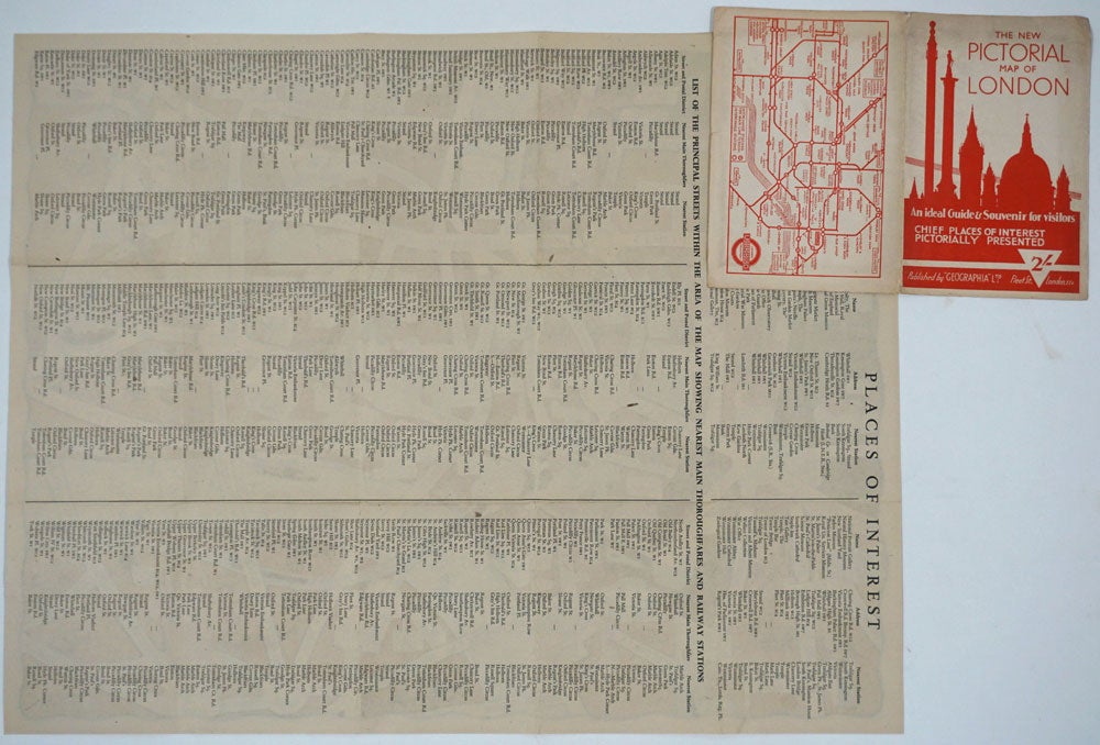
19 x 15", folds in to red pictorial printed wrappers with city skyline, with printed map of London Underground on verso, approximately 4 x 6". Verso with printed Index of Places of Interest and list of street locations showing nearest main thoroughfares and railway stations. Printed wrappers slightly dusty, the map bright and clean, the bold colors and yellow background quite vibrant. Very good overall. Item #26084
Sold