
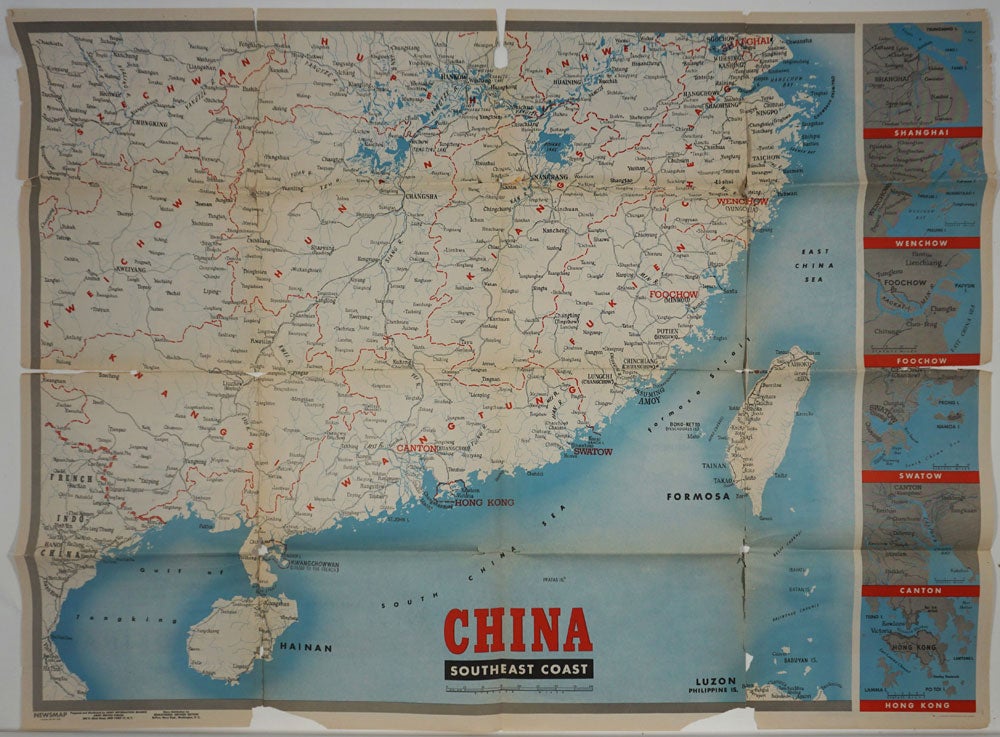
WWII Newsmap for the Armed Forces. China Southeast Coast.
New York: Army Information Branch, Army Service Forces, 1945. 291st Week of the War - 173rd Week of U.S. Participation. Monday, 9 April, 1945. Volume III, No. 51B.
Large printed color double sided folding map of China and its southeast coast, extending from Shanghai down to Formosa and Hainan and French Indo China. With inset maps of the vicinities of Hong Kong, Canton, Swatow, Foochow, Wenchow and Shanghai printed down the right side.
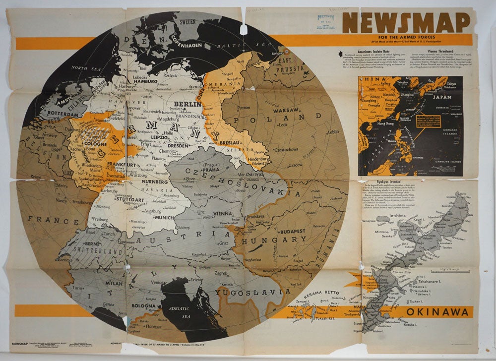
On the verso, text and three smaller maps: a large map of the European theater of operations, centered on Germany, and extending down to northern Italy and Yugoslavia; a map of the Pacific area (showing American occupation of Okinawa); and a detailed map of Okinawa at the lower right.
These war maps were issued by the US War Department in WWII to the public and to military personnel as visual guides to campaigns, and usually featured the theater of conflict, and often included text descriptions of war related events.
47 x 35", printed on both sides. Volume III, No. 51B printed at lower left. Some cracks at fold intersections, slight loss; chipped at edges. Michigan State Library stamp on verso. Good + condition. Item #26118
Sold