
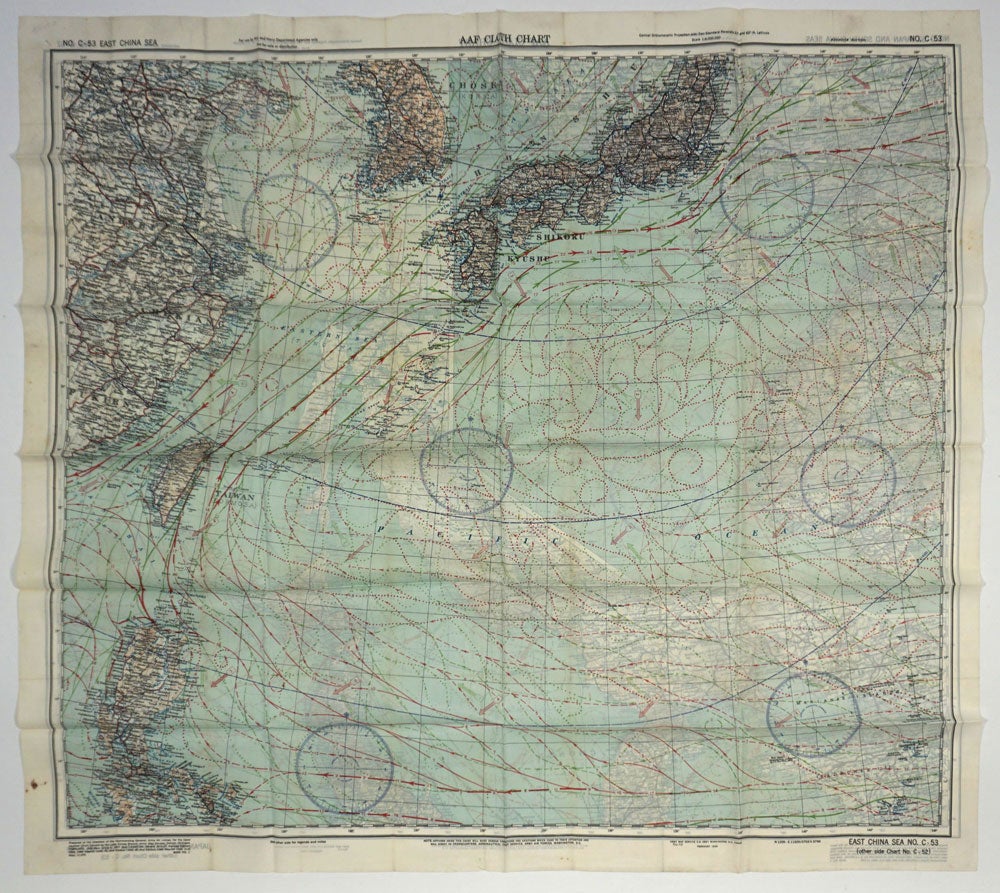
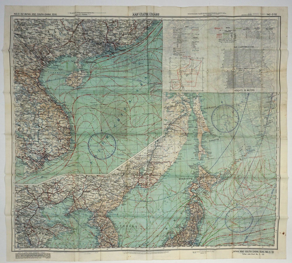
US Army Air Force cloth map, No. C-52, Japan and South China; No. C-53, East China Sea, "AAF Cloth Chart"
Washington DC: Army Map Service, U.S. Army, May 1945. Advance Edition. Two sided World War II color cloth escape map of Japan and southern China, part of an escape kit issued to American pilots in the area. This map has the words "Advance Edition" in the top margin and the latest date of February 1945 in the edition details in the lower left margin.
C-52 showing two views of Japan and the southwest coast of China, Hong Kong, Vietnam, Cambodia and part of the Malaysian peninsula, with rivers, mountain ranges, formed roads, international boundaries, railroads, cities, rivers, and spot elevation. C-53 verso with East China Sea down to Taiwan and northern Philippines, showing November to March currents in red.
Cloth, printed on both sides in color. 32 x 30". Very clean and bright, period folds, small dark stain in one margin. OCLC: 1016184028 locates only one copy, at McMaster University. Very good overall. Item #26318
Sold