
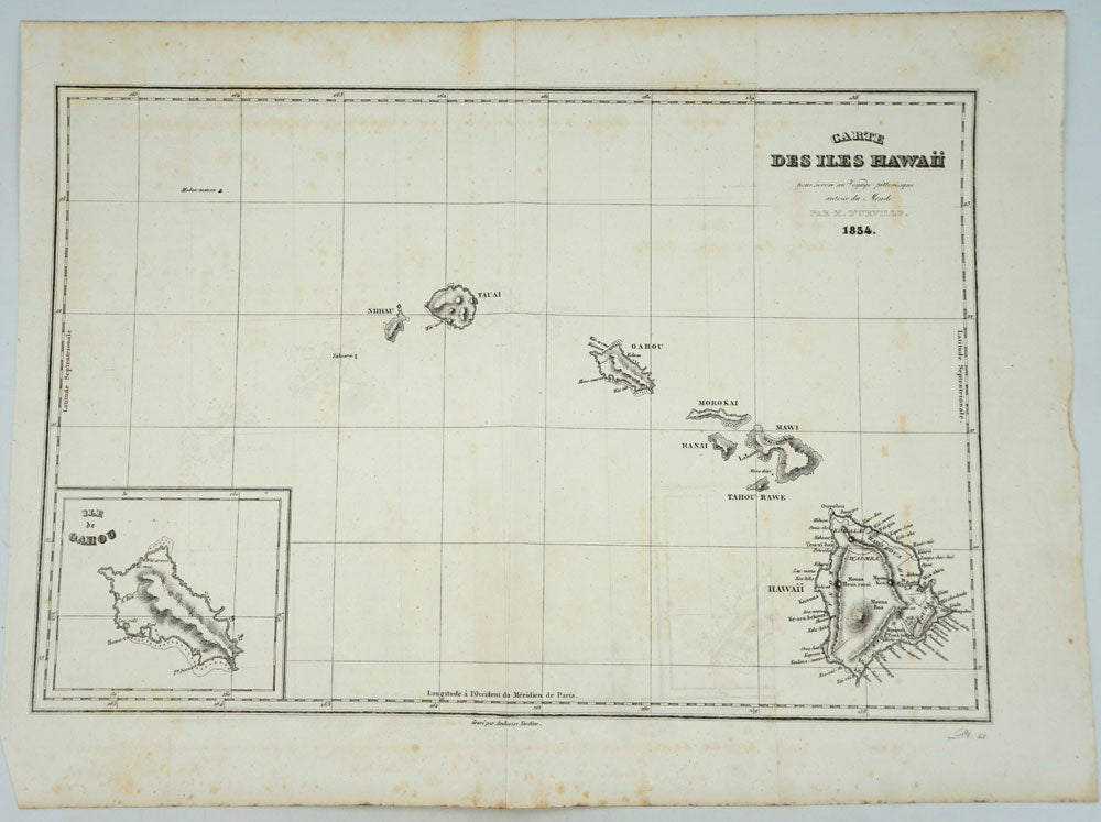
Carte des Iles Hawaii 1834 from "Voyage Pittoresque autour du Monde"
Paris: 1834. Hawaiian Islands 1834 from the Voyages of Dumont D'Urville. Depicts Nihau, Tauai, Oahou, Morokai, Ranai, Mawi, Tahou Rawe and Hawaii. Inset of the Ile de Oahou. Engraved by Ambroise Tardieu.
Dumont d'Urville circumnavigated the globe for the second time between 1826 and 1829. On this expedition his accomplishments included significant Pacific discoveries. His records were so detailed that for the first time the scattered islands of the South Pacific could be divided into three major groups: Melanesia, Polynesia and Micronesia.
Jules Sebastien Cesar Dumont D'Urville (1790 -- 1842) was a French explorer and naval officer who explored the south and western Pacific, Australia, New Zealand and Antarctica. As a botanist and cartographer he gave his name to several seaweeds, plants and shrubs, and places including d'Urville Island in New Zealand.
13 x 9", original folds, very slt. fox spotting outer edge. Very good condition. Item #26377
Price: $350.00