
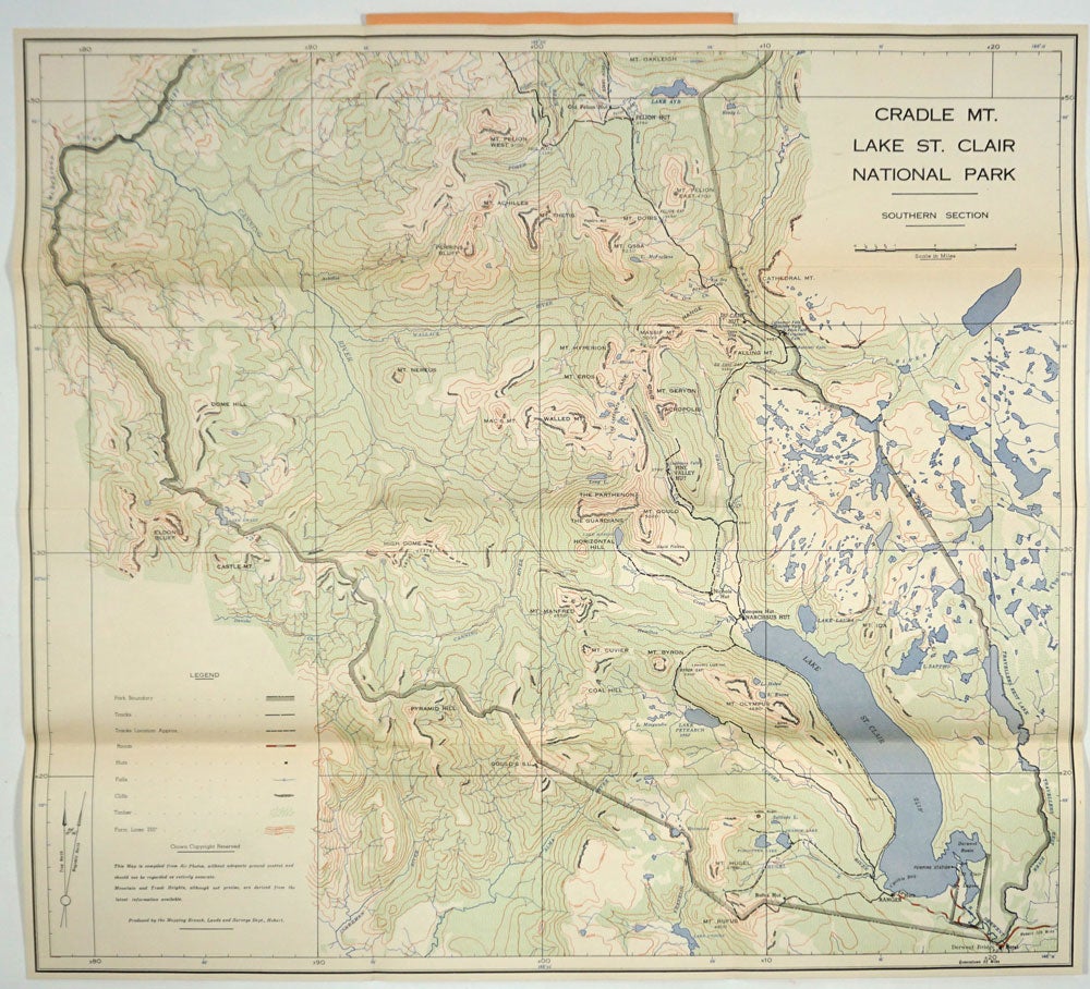
Cradle Mt. Lake St. Clair National Park, Southern Section, map.
Hobart, Tasmania: Lands & Surveys Dept. 1950. A topographical map of the northwest in Tasmania, specifically Southern Section of the Cradle Mt. Lake St. Clair National Park.
The map is bound by the Murchison River on the east to Travellers Rest River on the west, Mt. Oakley in the north to Mt. Rufus in the south. 'This map is compiled from air photos, without adequate ground control and should not be regarded as entirely accurate. Mountain and track heights, although not precise, are derived from the latest information available.'
9 1/8 X 6 1/4" unfolds to 26 1/2 X 24". The map is in very good condition, bound in orange card wrappers, blue titles on front and back. Number 522 stamped on front cover. Rear upper corner bent, spine slightly sunned, otherwise clean and bright throughout. Libraries Australia ID 24174985 at 4 libraries. Very good condition. Item #27259
Price: $125.00