
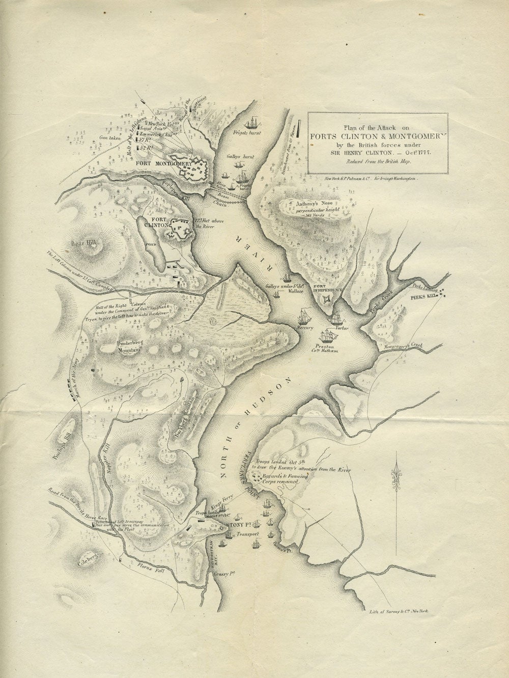
Plan of the Attack on Forts Clinton & Montgomery by the British forces under Sir Henry Clinton Oct 1777. Reduced from the British Map.
New York: G.P. Putnam & Co./Sarony & Co., c. 1855. This map illustrates the Revolutionary War battles in and near the Hudson Highlands, showing the chain across the Hudson and details of the Battle of Stony Point and the Battle of Fort Montgomery. The Hudson is the main focus with various other tributaries including Peeks Creek, Poplopen Kill, Macgregory's Creek, Nappies Kill and Florus Fall emptying into Haverstraw Bay. 20 ships dot the river in the Highlands and near Stony Point. Ships' names include Preston, Mercury and Tartar off of Peekskill, Galleys under Sir Jas. Wallace. The three forts are Fort Clinton, Fort Montgomery, and Fort Independence (Peekskill). The topography is indicated by shading and mountains include "Bear Hill" (Bear Mountain); Anthony's Nose "perpendicular height 363 Yards", Burkberg Mountain (Dunderburg).
In the river are notations "Frigate burnt; Galleys burnt' Sloop taken, Boom chain. On the shores of the river are dates of battles, the different regiments and other details of the battles for the Highlands in 1777.
It is based on the map drawn by British cartographer William Faden, whose maps were printed in Charles Stedman's history of the Revolutionary War in 1794
Lithograph, 11 3/8 x 9", original folds, closed tear on left margin not affecting map. Very good overall. Item #28008
Price: $150.00