
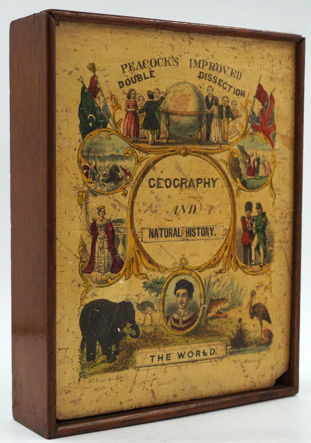
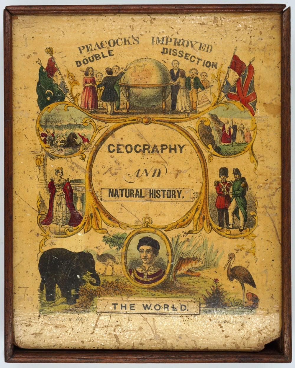
Peacock's Improved Double Dissection. Geography and Natural History. The World.
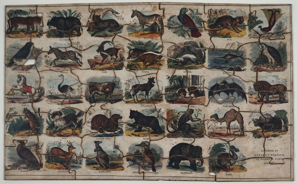
London: Edward J. Peacock, 65 Goswell Rd. ca. 1853. An unrecorded children's puzzle comprising a double hemisphere map of the world on one side and animals of the world on the verso, which include the Lyrebird & Kangaroo.
George James Peacock was a Baptist minister & a carpenter. He had managed the prominent children's education puzzle firm of Edward Wallis in London in the late 1830s and early 1840s. Then, in 1841, he took his family to Australia, where he was a policeman, missionary to the aborigines, school teacher and finally a postmaster. He was the schoolmaster of the Merri Creek Aboriginal School and Protectorate Station from Dec 1845 to May 1848. He most likely went to the Australian gold rushes and according to Grace's Guide to British Industrial History, he "returned to the UK having 'made his pile' and opened Peacock and Co, making children's furniture, toys and "Dissected Maps".
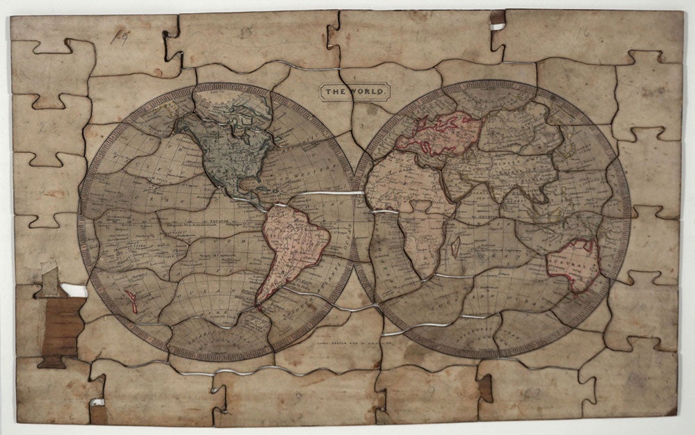
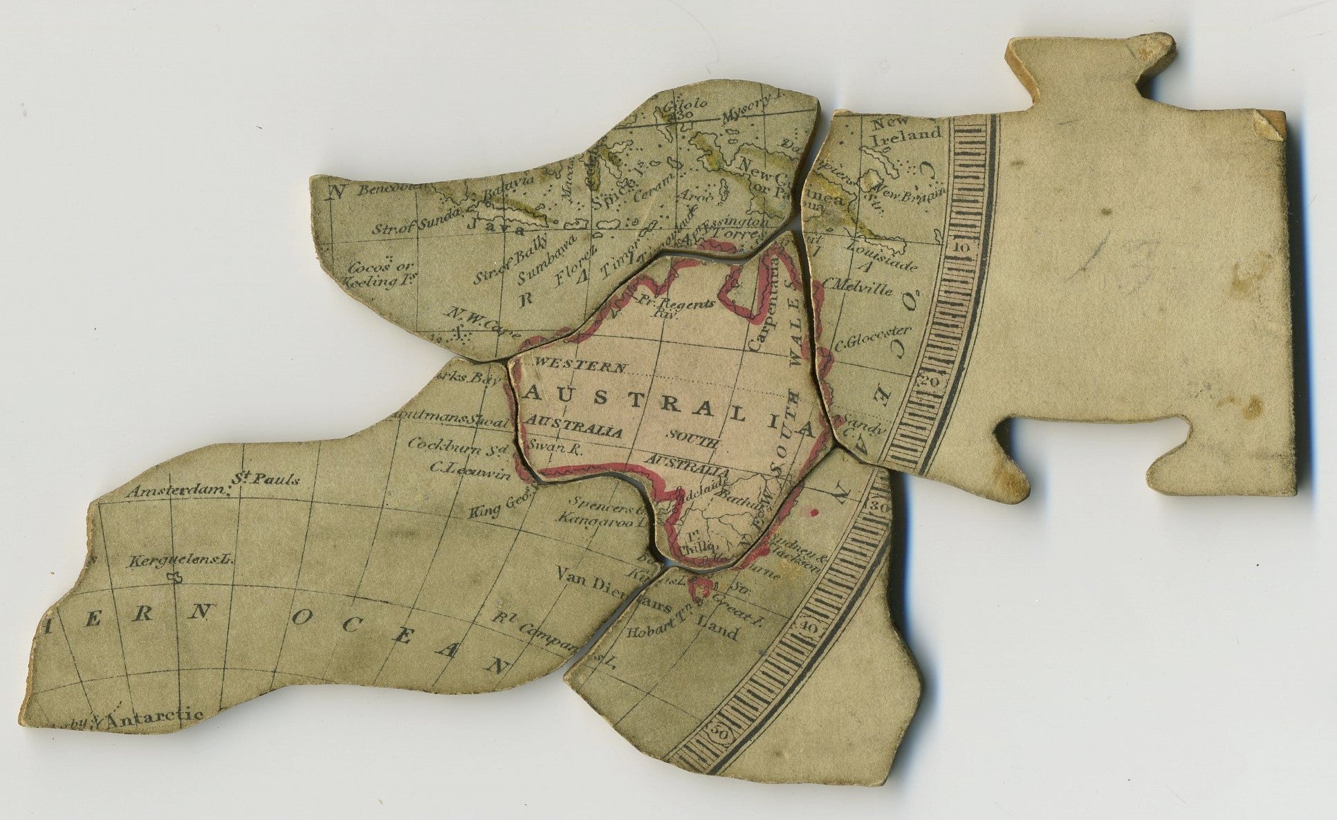
There is an extraordinary depth of detail on the map of Australia. Place names include North Australia, Carpentaria, South Australia, Port Phillip, Melbourne, Bathurst, New South Wales, Spencers Gulf, Kangaroo I. Bass Str.,Sydney & Pt. Jackson, Hobart Tn, Van Diemans Land, Great I., Kings I., Sandy C., C. Glocester, C. Melville, Pt. Essington & Torres Str. The Darling and Murray Rivers are delineated. The Darling is dotted-in where it joins the Murray. Western Australia place names include Prince Regent River, Swan R., King George Sound, Cockburn Sound, C. Leeuwin, N.W. Cape, Sharks Bay, Houtman Shoals. The Prince Regent River was named by P. Parker King in 1820. Victoria and Queensland have not yet been so named. North America features Texas with no boundaries. Antarctic place names include Enderby Land, south of Kerguelen Island and Palmers Land or South Shetland. North of Canada shows Parry Island and North Devon. The map "The World" is printed by Darton and Co 58 Holborn Hill (London).
The natural history puzzle has period colored vignettes of interesting animals of the world, including the lyrebird, kangaroo & gigantic kingfisher (kookaburra). Others include the lion, tiger, rhinoceros, camel, skunk, dog, guinea pig. This side bears the inscription "Published by Edward J. Peacock, 63 Goswell Road, London".
In the original wooden box with attractive color lithographed label bears the address "St. James & Wall... Clerkenwell". Wooden puzzle with paper images on both sides, complete with 59 pieces, a couple with some corners chipped. The puzzle measures 18 3/4 x 11 1/2 in, the box 7 1/8 x 9 x 2". The box label reads "Peacock's Improved Double Dissection. Geography And Natural History. The World", with the address "St. James & Wall... Clerkenwell". The image shows children examining a globe larger than they stand, British military, the Queen, four flags with animals at the base.
Not recorded on OCLC. There are two other double dissections, of America & Europe, at Yale. (OCLC: 1050918510 & OCLC: 1012413522). The V & A holds one puzzle produced by William Peacock & co, Printer Gall & Inglis, Bernard Terrace, Edinburgh & 25 Paternoster Square, London, after 1875. This puzzle clearly predates that item.
Some paper loss to map blank margin. Dusty and rubbed o/w very good condition. Item #6089
Sold