
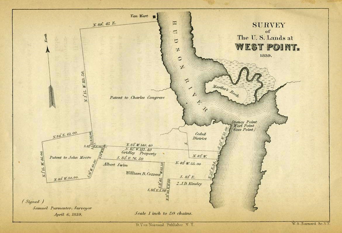
Survey of U. S. Lands at West Point. 1839.
New York: D. Van Nostrand. Survey of the lands on the west bank of the Hudson River, showing Stoney Point (sic), West Point, (Gees Point), and the names of all the patents surrounding the point, including: Patent to Charles Congreve; Patent to John Moore; Gridley Property; Albert Swim; William B. Cozzens; Z. J. D. Kinsley; and the Ceded District for the academy. At the lower left:"(Signed) Samuel Parmenter, Surveyor, April 6, 1839". Scale 1 inch to 50 chains. Across the Hudson from West Point lies "Martler's Rock", now known as Constitution Island, and at the very top, just north of the Congreve patent, a property is marked "Van Wart". From Boynton's History of West Point. 7 1/4 x 5" Very good condition. Item #17355
Price: $75.00