
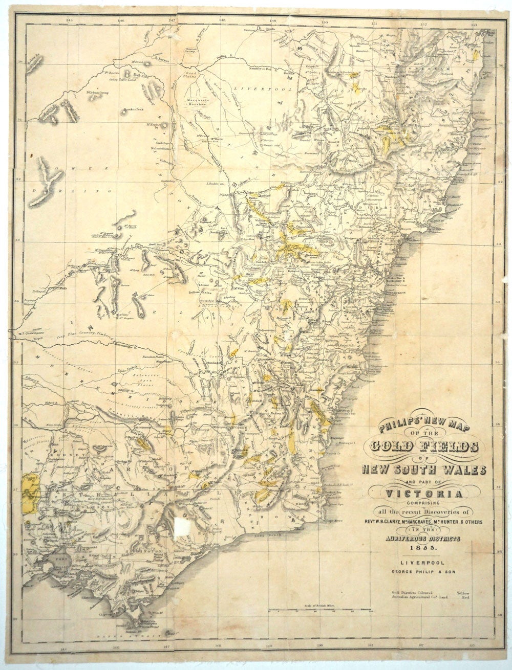
Philip's New Map of the Gold Fields of New South Wales and Part of Victoria comprising all the Recent Discoveries of Revd. W. B. Clarke, Mr. Hargraves, Mr. Hunter and others in the Auriferous Districts 1853.
Liverpool: George Philip & Son, 1853. Maps. Lithographed linen backed map of southeastern Australia and its gold fields. Philip seems to have issued this map with this title in 1852 and 1853. There are 3 copies recorded on Trove. However, there are variations which include the absence or presence of the following points- "Engraved by J. Gellatly, Edinr."; "Gold Districts Coloured... Yellow / Australian Agricultural Cos. Land... Red" below the title; a decorative border which encompasses the lat. & longitude 145 to 153 in circles or a plain ruled border which includes the long. numbers simply above the rule line.
Our copy is unrecorded in that it includes the notation about Australian Agricultural Land (the red not apparent on map, while the yellow for the gold districts is vivid) and has a simple ruled border that includes long. 145-153.
Lib Aus ID 44599038 / FL3781185 is visually the most similar to our copy with these differences: the library copy includes the Engraver Gellatly (ours does not); lacks the note about "Goldfields coloured" and lacks the long. number "153" at the bottom margin. The title "Victoria Part of Australia Felix" is printed in the state which was created a couple of years earlier, in 1851. Recently discovered gold finds are shown highlighted in yellow.
Map of area from the Clarence River in the north, to west of Port Phillip in the South. Recently discovered gold finds are highlighted in yellow. Most of the gold fields are shown situated in NSW as they were the earliest discovered - Bathurst, Turon River, Ophir, Summerhill. Also marked is Tamworth, Goulbourn, Quenbeyan and Araluen. Interestingly, Lake George is mapped but denoted as "dry". In Victoria, there are many more gold fields than the 1852 first edition. Fields include: Mt. Buninyoung (with road from Geelong), Mt. Alexander, the Plenty Ranges, the Yarra Yarra River, Mt. Gibbo, the May Day Hills, Mt. Tambo, and Mt. Wellington.
George Philip was born in Aberdeenshire in 1799. He started business in 1834 working first in Liverpool, his son joined him in 1848 and they then moved to London in 1856, where they issued maps up until the 1890s. It is very unusual to find separately published Australian maps- they tend to be practical guides to gold seekers and issued without the protection of boards, and were usually destroyed with use. Important early map of the Australian discoveries. There is however a small defect east of the Australian Alps, a small rectangular section, roughly 1/2" square below the "o" in Victoria; there is some marginal chipping that has been restored as well. See illustration. Archivally backed in linen, 18 5/8 x 24".
Three copies held in Australia include: Libraries Australia ID 44599405 & Bib ID 3552844- Dated 1853 in the title; no "Note" regarding gold below the title; decorative border that includes Lat. (153) in the lower margin; no reference to George Philip & Son below the rule line.
The copy at the SLNSW (FL3780907) has the note below "George Philip & Son- "Note: Goldfields coloured yellow".
The third copy, Libraries Australia ID 44599038, includes the Engraver Gellatly (ours does not); lacks the note about "Goldfields coloured" and lacks the long. number "153" at the bottom margin. Good condition. Item #15285
Price: $750.00