
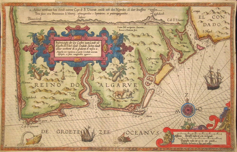
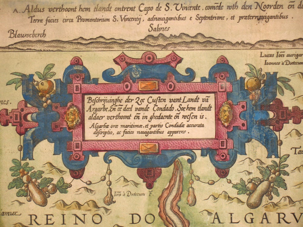
Beschrijvinghe der Zee Custen vant Landt va Argarbe En ee deel vande Condado, Soe hem tlandt aldaer verthoonten in ghendaente en mesen is -- Algarbae orae maritimae, et partis Coridadae accurata descriptio, ac facies navigantibus apparens.
Antwerp: 1584. Fine original hand colored map of the Algarve coastline (southern Portugal bordering the Mediterranean) from Waghenaer's "Spieghel der Zeevaerdt", the earliest one of this region. Mariners' Mirror was an atlas of nautical charts and sailing directions, with navigating instructions for western European coasts, the first of its kind in maritime cartography which set the standard for future map makers. Engraved by Baptist and Jan van Doetecum. With a highly ornate blue and rose bordered cartouche & sea monsters and galleons below. Image: 20 1/8 x 14", paper size: 20 1/4 x 14". Issued folded; with a small marginal repair to the top edge of the map near the fold, very good condition. "This work holds a unique place among the printed rutters of the sea in the 16th century because it is the first printed rutter with charts. Further, it outranks any other rutter of its period, with its splendid presentation of charts and text; as such it stood as a model for the folio-size pilot-guides with charts in the 17th century. Thanks to the unparalleled skill of the engravers, Baptist and Johannes van Deutecom, the original ms. charts by Waghenaer were transformed into the most beautiful maps of the period. The composition and the adornment have greatly contributed to the splendour of what originally were simple sketch-charts; the typography of the Plantijn printing house at Leiden further added to the quality of the book. In its concept, the text follows the traditional composition of the 16th century pilot-guides but the charts form a new element. One remarkable feature is the coastal profiles projected onto the land along the coasts, further elucidated by profiles drawn in the open areas of the charts. There is no evidence that Waghenaer copied his charts from existing sources. Some of them must have been based on his personal observations and for the whole of the work he must have relied on his own rich experience in practical navigation". (Koeman). Item #15837
Price: $2,250.00