
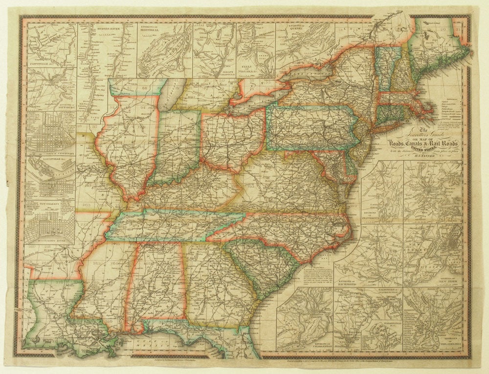
The Travellers Guide or Map of the Roads, Canals & Rail Roads of the United States, with the distances from place to place.
Philadelphia: H. S. Tanner, 144 Chestnut St, 1834. Original outline color map from Tanner's American Traveller guide book extending from the east coast of the United States to Missouri, Arkansas and Louisiana. Major towns, rivers, turnpike and common roads, rail routes, canals and steamboat routes are shown.
With eighteen inset maps of major cities and their environs including: Albany, Saratoga &c.; Baltimore & Washington; Cincinnati; Environs of Boston; Environs of Charleston; Environs of Montreal; Environs of New York; Environs of Philadelphia; Environs of Pittsburg; Environs of Providence; Environs of Quebec; Environs of Richmond; Falls of Niagara &c.; Hudson River; Louisville &c.; New Orleans; Pottsville &c.; and Washington D.C.
The inset of the Hudson River extends from Staten Island up to Kingston, New York.
Image size: 22 1/2 x 18 1/4". Paper size: 23 1/4 x 19 1/4". OCLC: 1084637886 locates one copy at the Library of Congress. Beautiful period hand color, very good condition, no cracking. Very good condition. Item #15891
Price: $1,250.00