
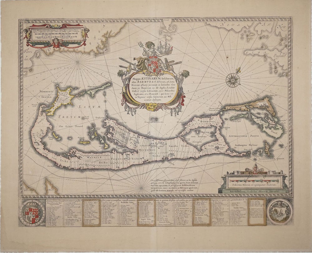
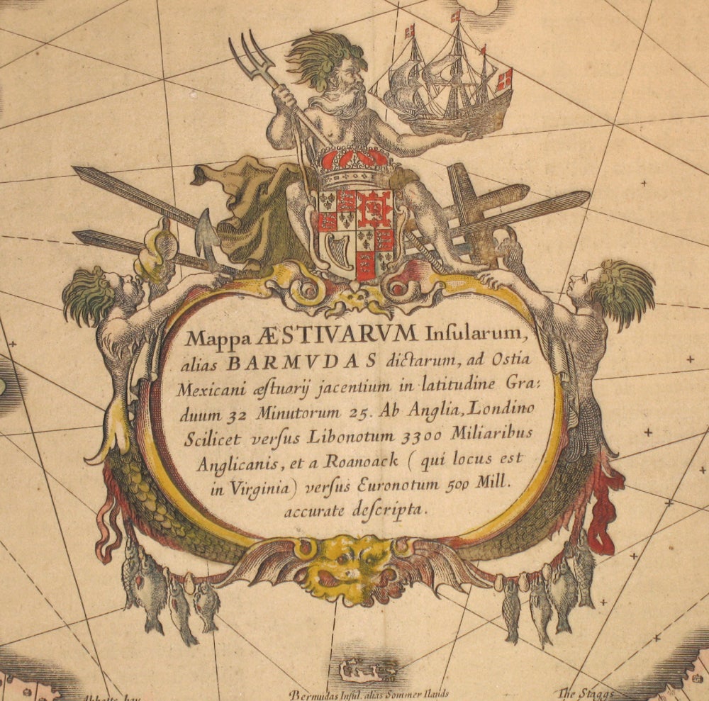
Mappa Aestiuarum Insularum, alias Barmudas.
Amsterdam. Ca. 1640. Color copper engraved map of Bermuda, shown divided into sections belonging to eight tribes, which were areas of land partitioned among investors in the Somers Isle Company; these were Devonshire, Hamilton, Paget, Pembroke, Sandys, Smith's, Southampton and Warwick, all represented here. Also showing the east coast of the United States from Florida up to Cape Cod (Ca. Codd). With text across the bottom pertaining to the tribes. With Bermuda coat of arms. Elaborate title cartouche at top, with coat of arms, Neptune holding a ship and flanked by two mermaids, the one at the left blowing a conch shell. With two mileage scales. Reference: Tooley, Bermuda, p5. Image size: 21 x 16". Map uniformly toned, otherwise very good. Item #15899
Price: $2,250.00