
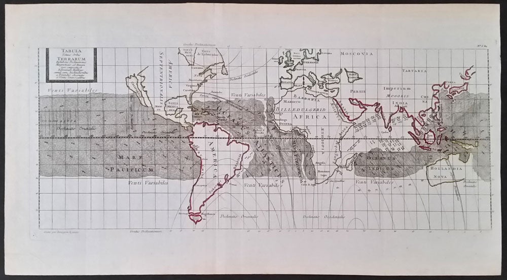
Tabula Totius Orbis Terrarum Exhibens Declinationes Magneticas, ad Annum 1700 composita ab Edmundo Halleyo simul cum Inclinationibus a Poundio observatis et Ventis Universalibus.
Paris: 1701. Ca. 1701. Edmund Halley's (discoverer of Halley's Comet) important chart of the world, showing the variations of the compass and winds, with original outline color. With Australia named 'Hollandia Nova', and with an incomplete coast line; New Zealand is not shown. North America with "Nova Brittania', Virginia, Carolina, Florida, and California as an island. From a French publication, with "Grave par Bourgoin le jeune" at the lower left, and No. 6 bis at the upper right. Image size: 19 1/2 x 8 1/2". With a very small hole at the Prime Meridian, not visible unless held to the light, otherwise very good. Item #15925
Price: $750.00
See all items by Edmund Halley