
Atlas of New York and Vicinity.
New York: F.W. Beers, 1867. Hardcover. Folio, 61 maps plus engraved table, many folding. This is a rare variant of the Beers atlas. Includes Westchester, Putnam & Dutchess County, which is unusual. 4pp lithographed prints of Bedford, Mahopac, North Salem.
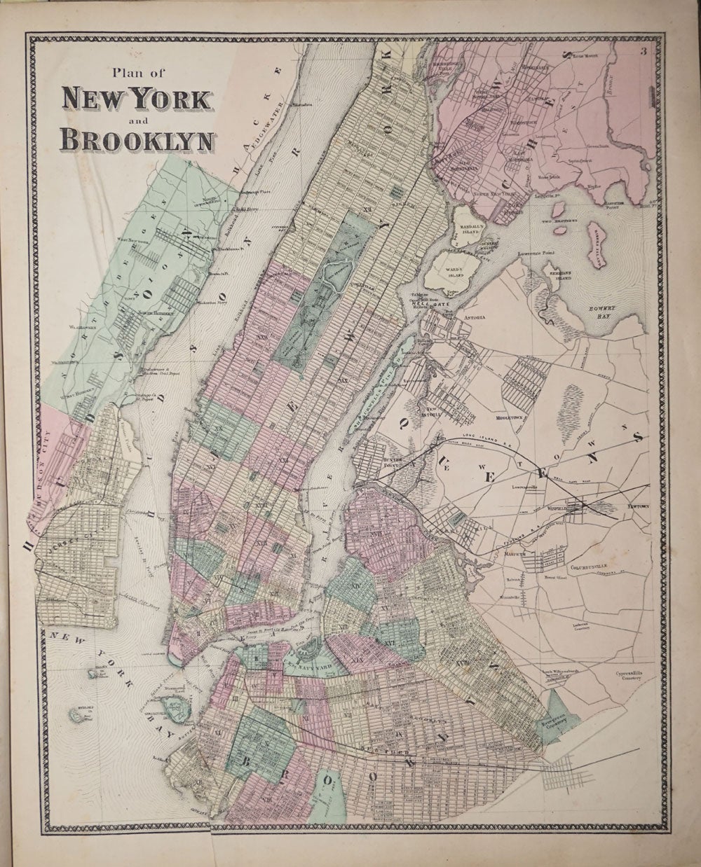
Maps include New York & Vicinity; New York, Brooklyn; West Farms, Westchester Morrisania; Town of Yonkers; City of Yonkers; Eastchester, Pelham & New Rochelle; Greenburgh; Beekman; Beekman Town; Mamaroneck, Scarsdale, White Plains; White Plains; Mt. Pleasant and Ossining; Borough of Sing Sing; Town of North Castle; Town of Newcastle, inset of Chappaqua; Bedford; Pound Ridge; Lewisboro incl. South Salem; Cortlandt; Peekskill; Yorktown; Somers & North Salem; Philipstown Putnam Valley; Cold Spring & Nelsonville; Carmel; Plan of Carmel Village; Southeast; Patterson & Brewsters Station; Patterson; Kent; Plan of Dutchess County; Plan of Fishkill; Plan of Mattewan; Plan of the Village of Fishkill; Wappingers Falls & Channingville; Town of East Fishkill; Beekman; Poughquag; Pawling; Town of Poughkeepskie; Plan of the City of Poughkeepsie; Town of LaGrange; Unionvale; Dover; Dover Plains & Pawling Station.
Plan of the town of Hyde Park and Village of Staatsburg, Plans of the villages of Hyde Park and Pleasant Valley, Plan of the town of Pleasant Valley, Plan of the town of Washington, Plans of the villages of Washington, Mabbettsville, Hart's Village, Strandfordville and Bangall, Plan of the town of Amenia, Plans of the villages of Amenia, South Amenia, City of Amenia, Union, and Wassaic, Plan of the town of Clinton, Plan of the town of Strandford, Plans of the towns of Northeast and villages of Millerton including Manhattan Iron Works, Plan of the town of Rhinebeck, Plan of the borough of Rhinebeck, Plans of Rhinecliff and villages of Clinton Hollow and Clinton Corners, Plan of the town of Red Hook, Plans of the villages of Tivoli, Madalin, Barrytown, Annandale and Upper Red Hook, Plan of the village of Red Hook, Plans of the town of Milan and villages of Jackson's Corner, Milanville, Rock City and Lafayetteville, Plan of the town and village of Pine Plains. Also 5 lithographic illustrations of homes & farms. bound in rear.
Map of NY on onion skin with a 12" closed tear, the rest of the folding maps (on onion skin) and the others (on cream paper) are in very nice condition. Orig. brown gilt stamped cloth boards marked, rubbed, black leather spine rubbed. Light damp mark on engravings at the back. Foxing in early margins. Item #16543
Price: $2,500.00