
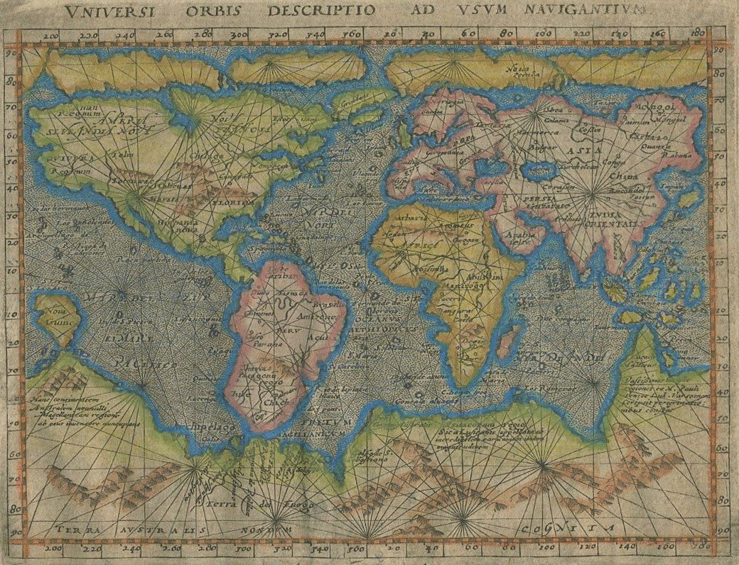
Universi Orbis Descriptio ad Usum Navigantium.
Cologne: 1597. A reduced scale world map based on Mercator's map of 1569, and published a year after the first Venice edition of 1596. Scarce pirate edition published by Petrus Keschedt, and not published between 1598 and 1608.
Drawn with a series of Arctic islands to the north, while a large solid land mass with mythical mountain ranges and rivers is to the extreme south. The straits of Magellan are shown, and across from them, Tierra del Fuego. Below Southern Africa is a province called Terra Australis. Australia is still shown as part of the Southern Land, but separated from the Java south coast; it includes Marco Polo's province of Lucach Maletur. New Guinea also shown as a separate island.
Attractive later hand color. Shirley, Mapping of the World, 204. 6 3/4 x 5"; 17 x 12.5 cm. Very good condition. Item #18144
Price: $950.00