
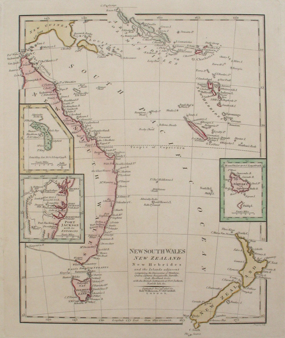
Map: New South Wales, New Zealand, New Hebrides and the Islands Adjacent, comprising the Discoveries of Mendana, Qurios, Carteret, Bougainville, Surveille, Cook, Shortland, &c.
London: Robert Wilkinson, 1808. Early map showing entire coast of New South Wales, showing the discoveries of early explorers, from the coast of New South Wales and Van Diemens Land, to New Zealand. From Wilkinson's General Atlas of the World.
The map extends from the Solomon Islands in the north to New South Wales and New Zealand in the southeast. Includes insets of Port Jackson, Howe & Norfolk Island. A detailed coastal map of New South Wales, showing the entire coast from Endeavour Strait down to South Cape on Van Diemens Land. Copper engraving with period hand color. Paper 11 x 13 1/2"; image size 9 3/4 x 12". Tooley 1363. Very good condition. Item #21182
Price: $275.00