
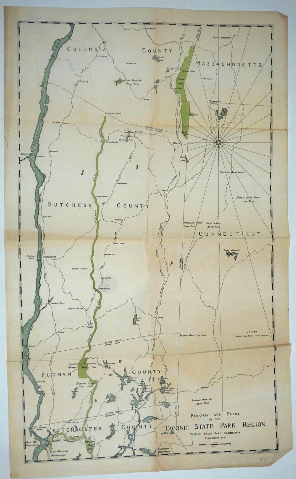
Parkway and Parks in the Taconic State Park Region. Map.
Varick Street, New York: Robert A. Welcke, c. 1930-1936. A color folding map extending north/south from Columbia County/Great Barrington to Westchester County/Mohansic Park and west/east Hudson River to Mohawk State Forest and Park. Scale is 5 miles = 2 inches.
Robert A. Welcke (fl. 1876 – c. 1940) was a photolithographer active in New York in the latter part of the 19th century and early 20th century. Welcke's firm, Robert A. Welcke Offset Company, was based at 176 William Street. Welcke's corpus of work ranges from maps of New York and Connecticut to illustrations on Flemish Renaissance interiors to government maps and brochures to decorative sheet music covers.
17 x 28", cream paper, original folds, one corner folded. Very clean. OCLC: 820009986 at one library. Very good condition. Item #25539
Sold