
WWII Newsmap for the Armed Forces. Mindanao Philippines; Burma, France, Western Pacific, Palau Islands, and Morotai.
New York: Army Information Branch, Army Service Forces, 1944. Monday, 25 September, 1944, Week of 13 September to 20 September. Volume III No. 23F.
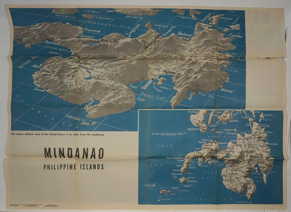
Large printed color double sided folding map, one side with map entitled Mindanao, Phillipine Islands, showing two views of the Philippines, one entitled, "The above oblique view of the island shows it as seen from the southwest".
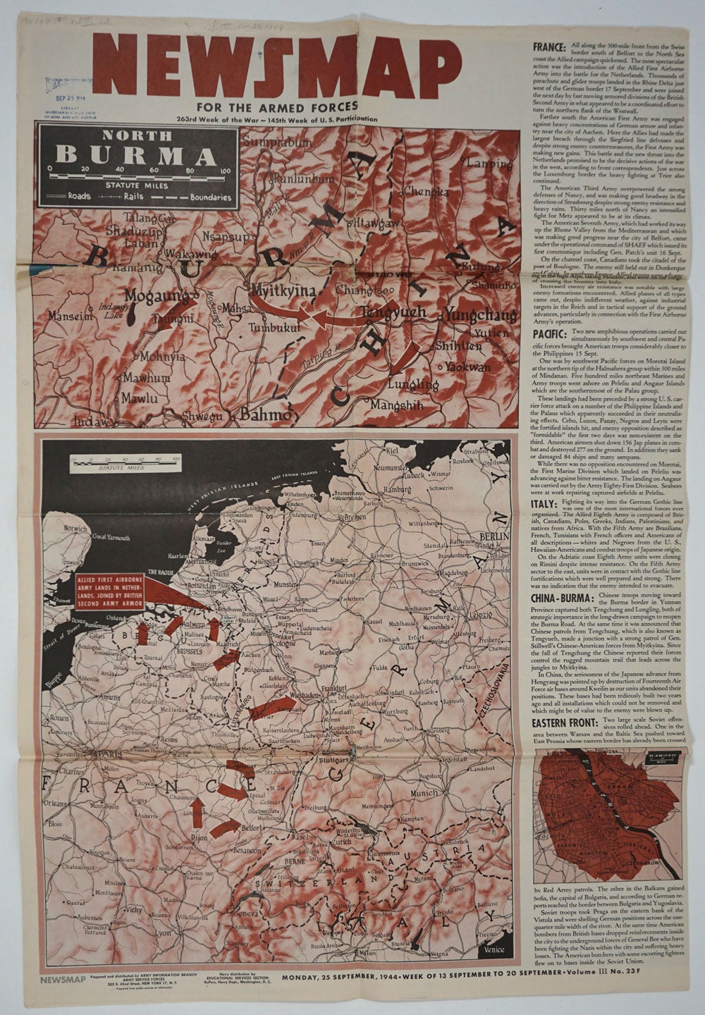
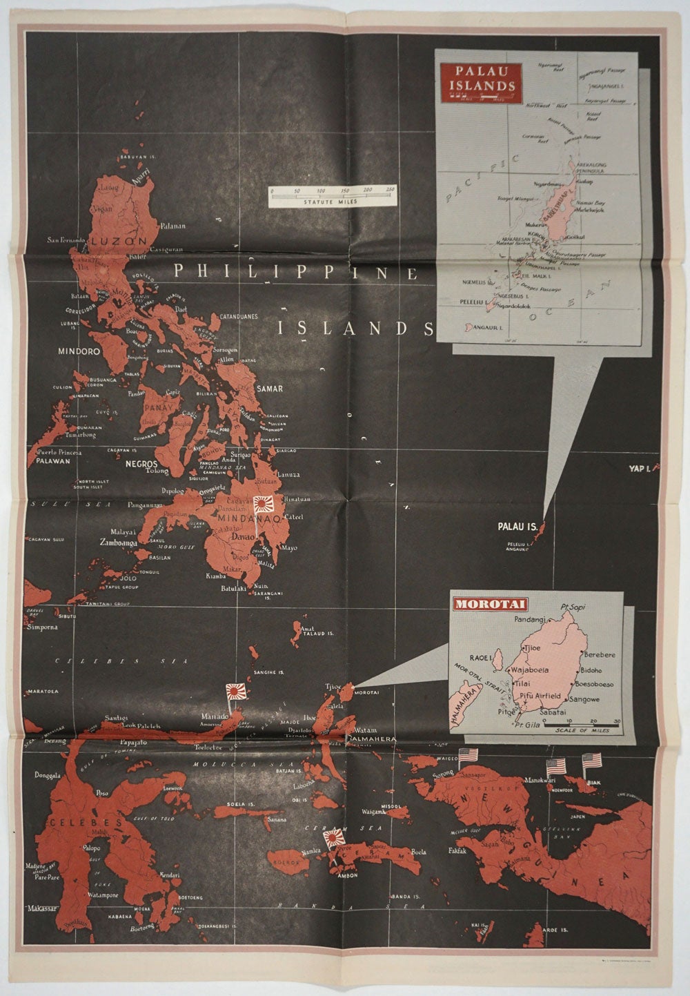
On verso, at left side, maps of North Burma and map of the western European theater, centered on Frankfurt Germany. Text to right provides information on France, Pacific, Italy, China-Burma, and Eastern Front. At far right, map of the Philippine Islands extending down to the Celebes and New Guinea, with inset maps of the Palau Islands and Morotai.
These war maps were issued by the US War Department in WWII to the public and to military personnel as visual guides to campaigns, and usually featured the theater of conflict, and often included text descriptions of war related events.
47 x 35", printed on both sides. Some cracking at fold intersections. Good + condition. Item #26117
Sold