
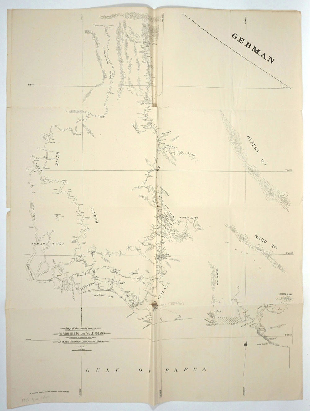
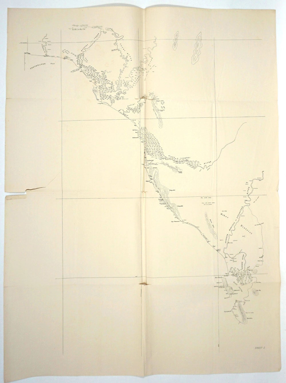
Map of the Country Between Purari Delta and Yule Island Resurveyed in Connection with Dr. Wade's Petroleum Exploration 1913-14. 2 maps.
Melbourne: Albert J. Mullett, Government Printer, 1915. Sheets 1 and 2, petroleum survey maps of an area of Papua New Guinea surveyed and mapped for the first time by Dr. Arthur Wade, working for the Australian government.
Arthur Wade (1878-1951), British geologist, worked for the Australian government as director of oil fields on the search for oil in Papua and Indonesia. Wade's 1913 expedtion was to the coastal belt near Port Moresby; it was noteworthy for surveying 3000 square miles of jungle and coast line, accurately mapping them for the first time.
In 1913 Wade was recommended to the Australian government to work on the search for oil in Papua; he produced his Report on Petroleum in Papua in 1914. As director of oil fields, he reported on petroleum prospects for Australia from 1915 to 1919. In the 1940s Wade became geological adviser to the Shell (Queensland) Development Co. of Australia.
2 maps, 102 x 77 cm. Period folds flattened, some splits at folds. Trove 22907015 at the National Library of Australia, University of Melbourne, and University of Queensland. Very good overall. Item #26167
Price: $150.00