
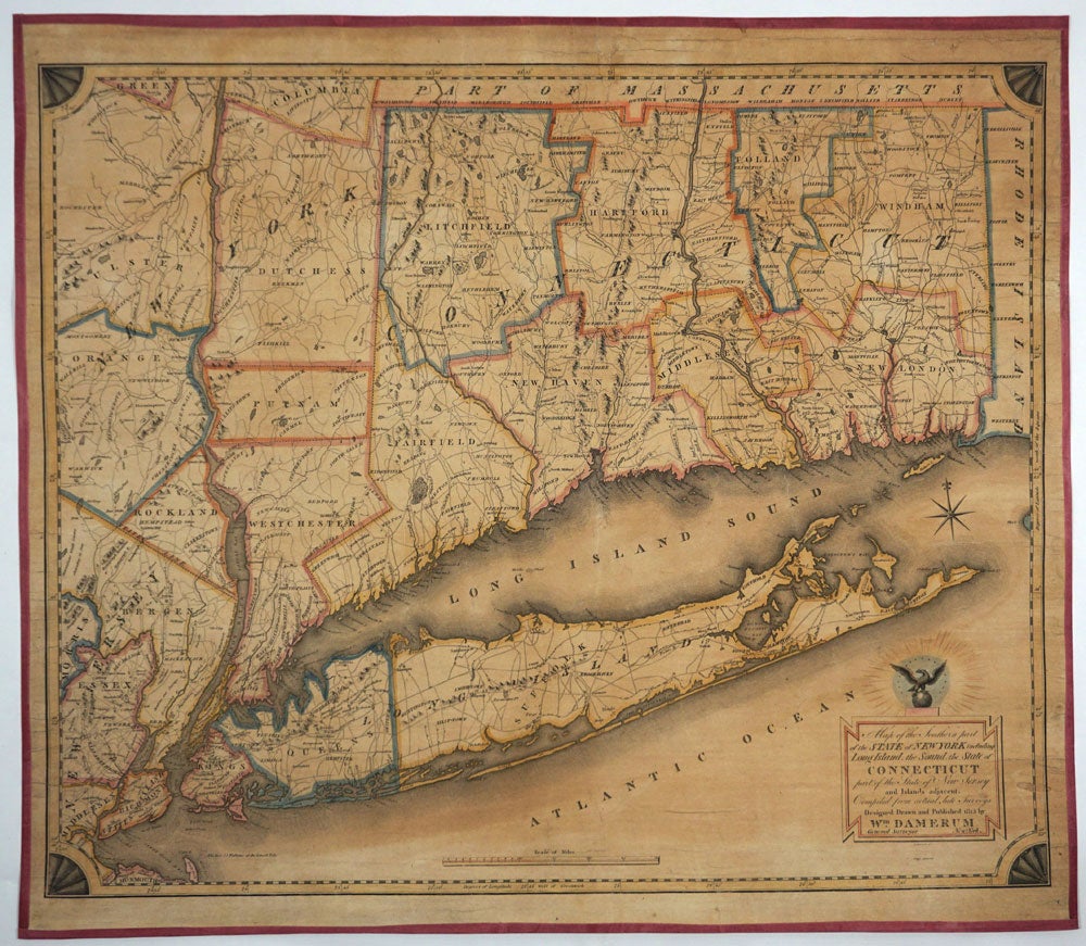
Map of the Southern part of the State of New York including Long Island, the Sound, the State of Connecticut, part of the State of New Jersey and Islands adjacent.
New York: Wm. Damerum, 1815. Rare wall map of the Tri-state area including all of Connecticut and Long Island, by Wm. Damerum "General Surveyor". A handsome engraving by Peter Maverick of the Maverick engraving family. Stephens (The Mavericks) 1121, second state with ‘Schyler’s copper mines.’ (in North Arlington, Bergen County, New Jersey.) Streeter Sale 900: “This map shows Long Island on an unusually large scale for such an early map. Thompson … describes the map as ‘A handsome engraving, quite rare. The thirteen Connecticut towns that were incorporated in the first decade of the century are shown.”
Original hand color in outline with some counties with wash color. Professionally laid on canvas, with pink silk border. Image 28 x 23" on 29 1/2 x 25 1/2". A few marginal tears, none significantly entering the map engraving.
From Rumsey: "Engraved by P. Maverick. Thompson: "A handsome engraving, quite rare." The sixteen stars that surround the eagle above the title supposedly represent the number of states in the union in 1815. Outline color by county. Reference: Streeter 900; Thompson 57; P-Maps 247, 509." Item #26906
Price: $8,500.00