
Hand-drawn maps of Sydney & Melbourne, by a USO employee during the 1940s.
c. 1942. A collection of maps, hand drawn most precisely, used by a USO employee during W.W.II, presumably to establish USO clubs in Australia, between 1941-49. There are detailed lists of banks, clubs, newspapers, churches, etc. for both Melbourne and Sydney, on "USO" letterhead. According to the Kansas Historical Society, this stationary was created by The Salvation Army and used between 1941 and 1949. The USO (United Services Organization) was established after 1941 by President Franklin Roosevelt, concerned about the welfare and spirits of those headed for battle. He appealed to the country to provide morale and recreational services to the troops. In response, six service agencies – YMCA, YWCA, Salvation Army, Jewish Welfare Board, Catholic Community Charities, and Travelers Aid Society – worked in partnership to create and support the launch of the United Service Organizations Inc. The names of these organizations are at the footer of the stationary.
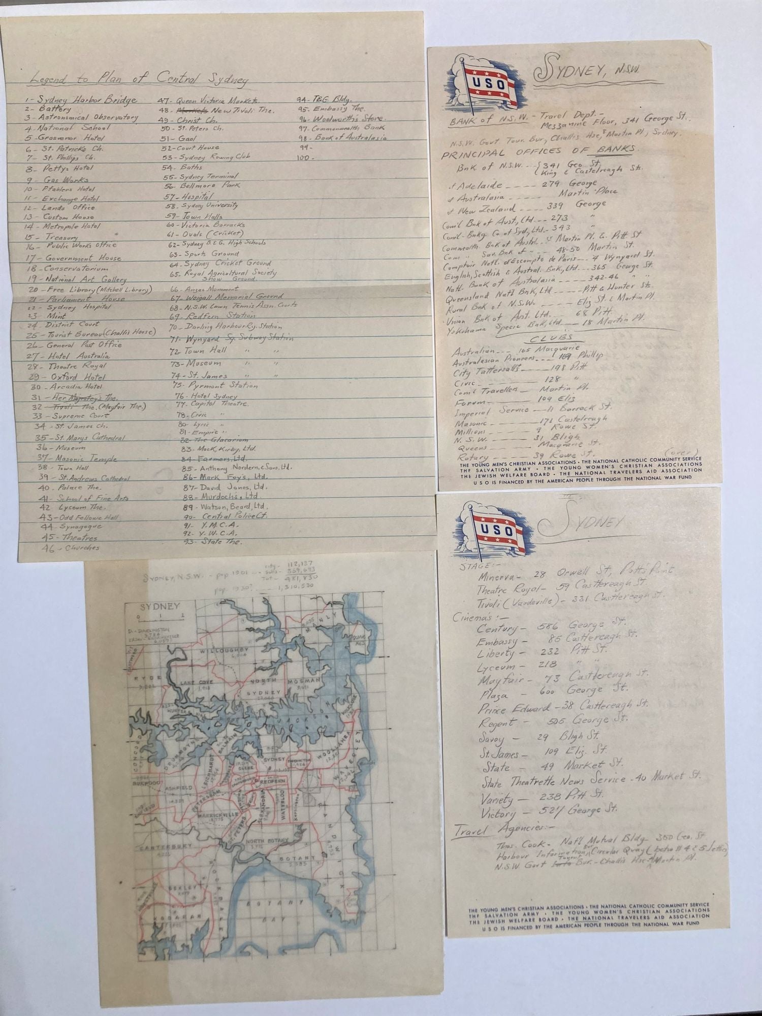
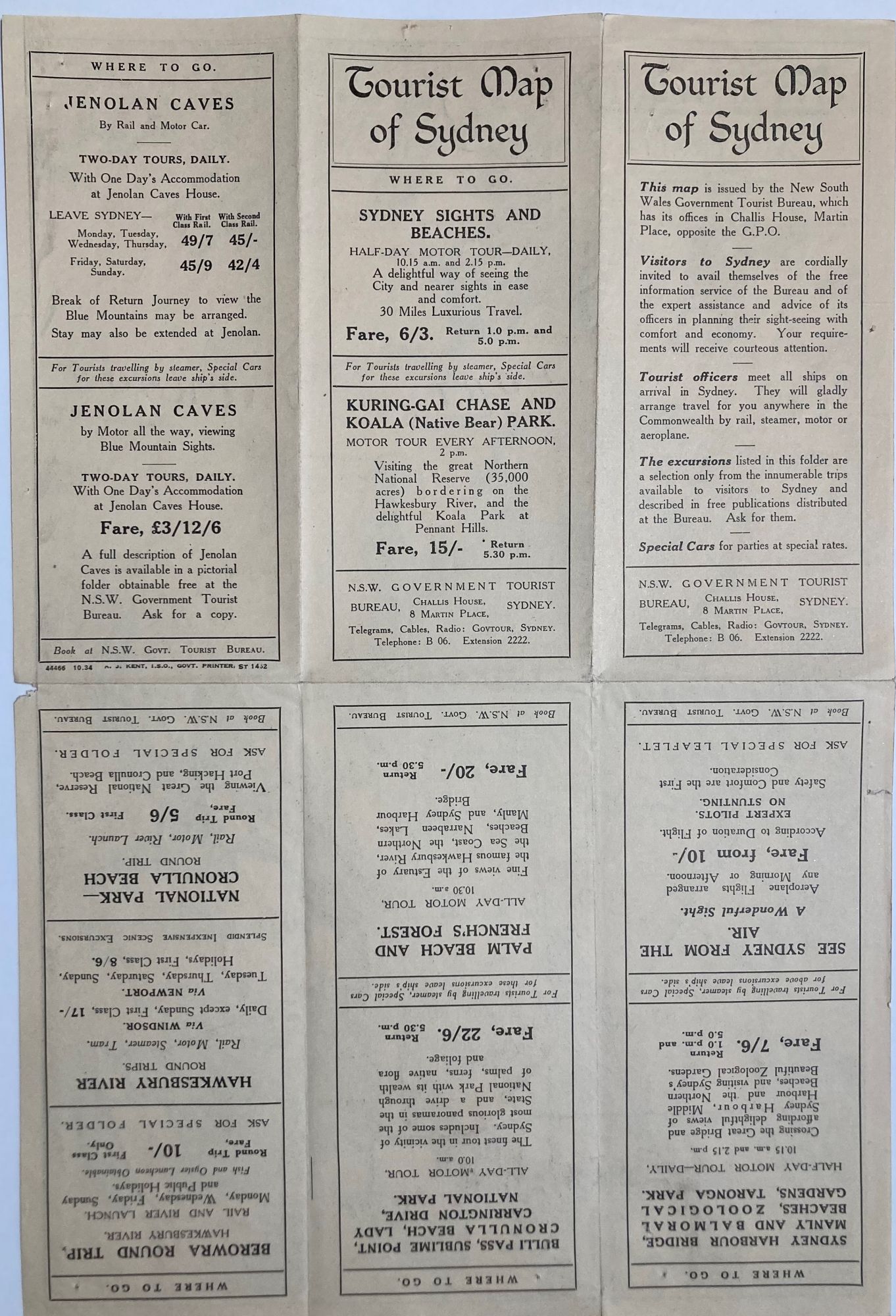
Sydney - 4pp lists, 1pp foolscap "Legend to Plan of Central Sydney", 1 printed map "Tourist Map of Sydney", 1934 & 8 hand drawn maps.
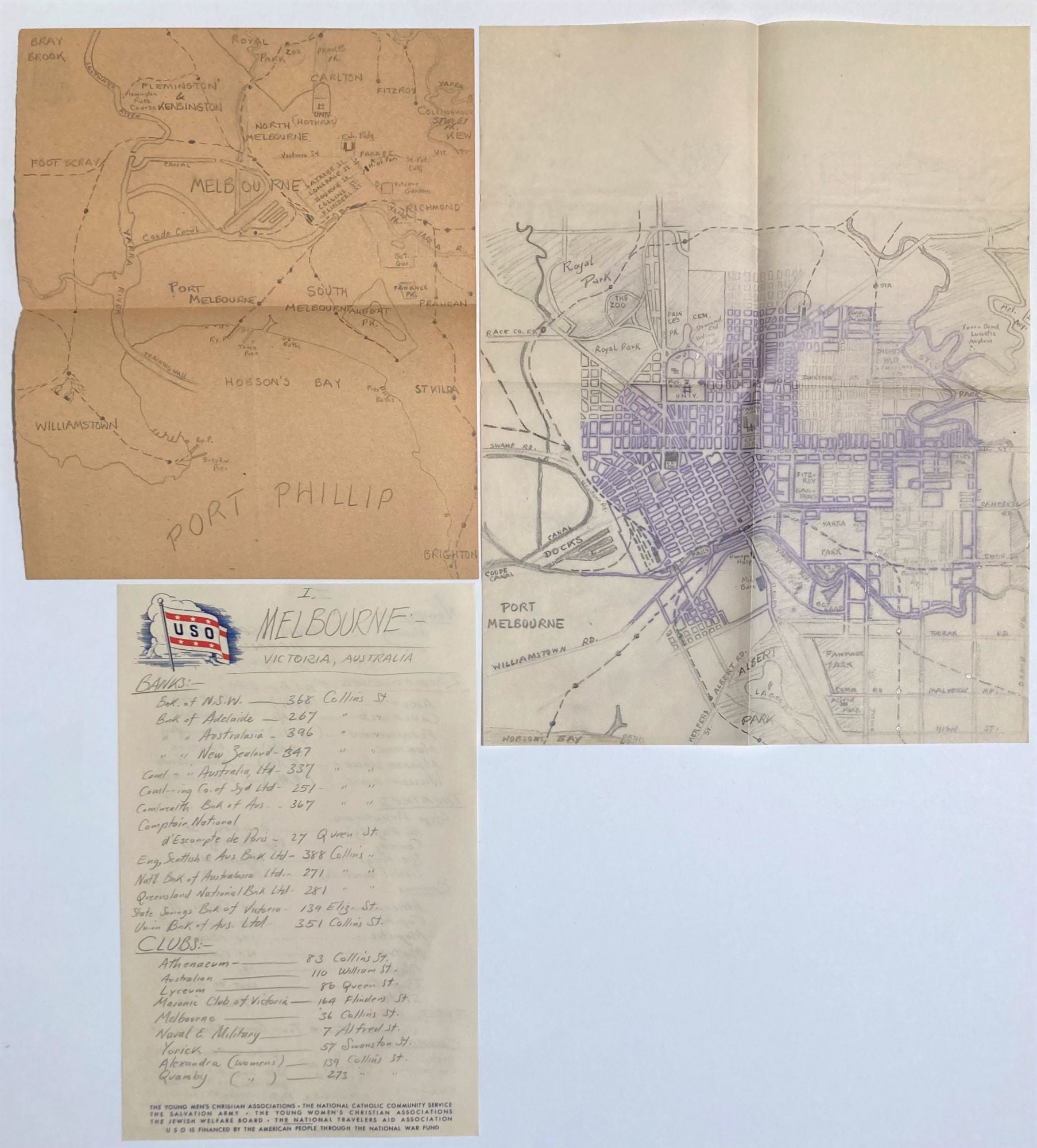
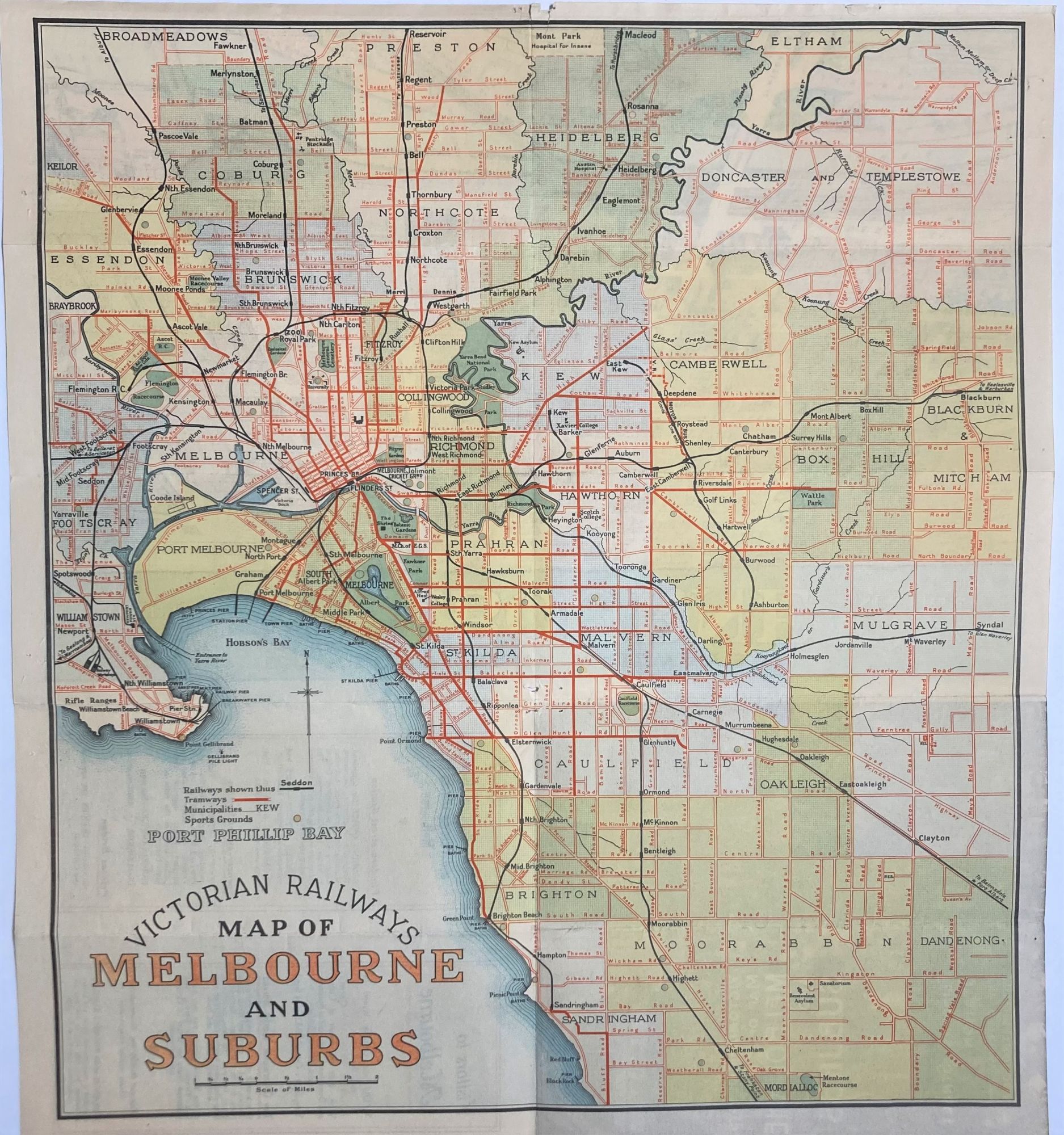
Melbourne - 2pp list, 1 printed map, "1934 Victorian railways map, "Victorian Railways map of Melbourne and suburbs : Flinders Street Station, the gateway of the metropolis", 4 hand drawn maps.
SYDNEY - 4pp handwritten of banks, newspapers, clubs, churches, etc., with their addresses, 98 in total, keyed to a "Legend to Plan of Central Sydney" and colored coded. The list includes Banks (15); Clubs (17); Newspapers (8 including SMH, Daily Telegraph & Daily News in the morning; The Sun & Mirror in the Evening; Sunday Sun, Sunday Telegraph and Truth on Sundays); Cafes- Cahills, Carl Thomas Club, Princes, Romano's, Vere Mathews, marked with an x if there was "dancing"; Racecourses (10); Stage (3); Cinemas (14); Travel Agencies (3); Churches (20) including Baptist, Christadelphian, Congregational, Jewish, Methodist, Presbyterian, Roman Catholic, Salvation Army, Seventh Day Adventists, Unitarian; Church of England.
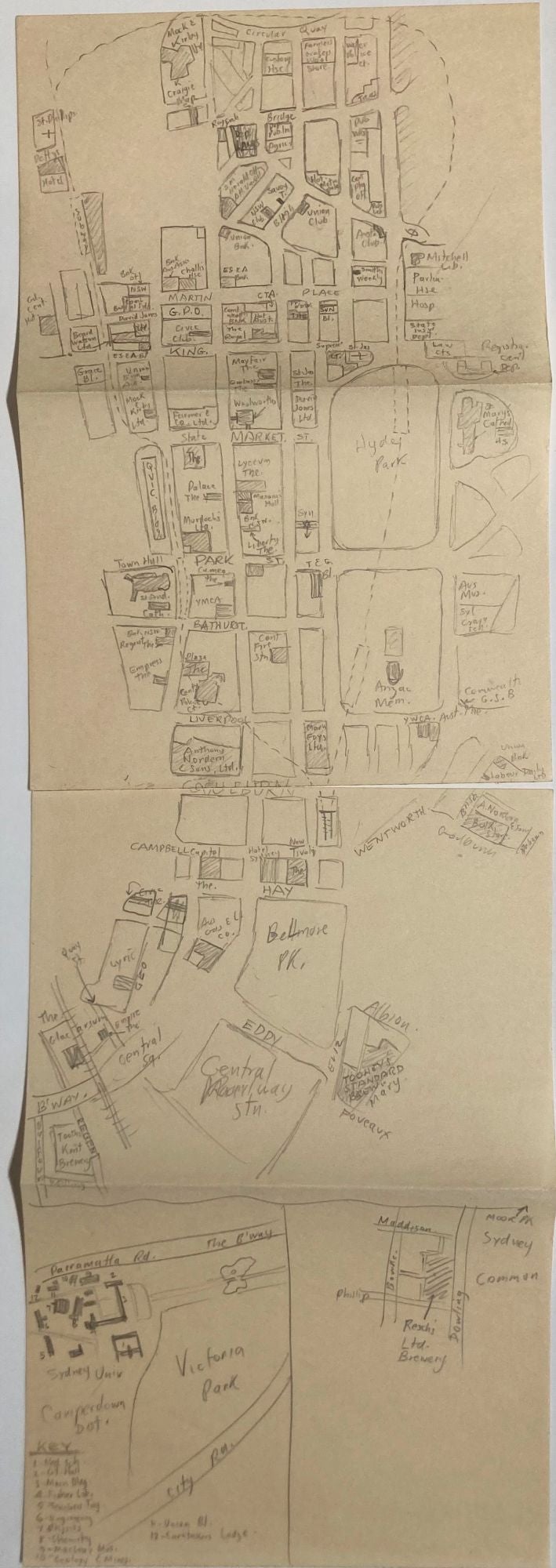
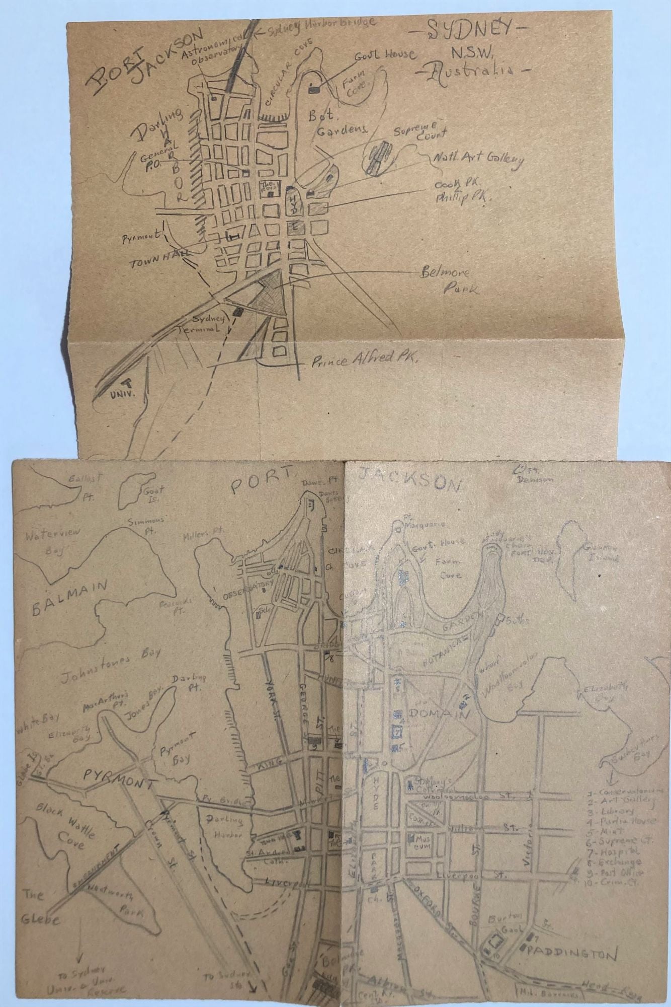
Maps of Sydney -
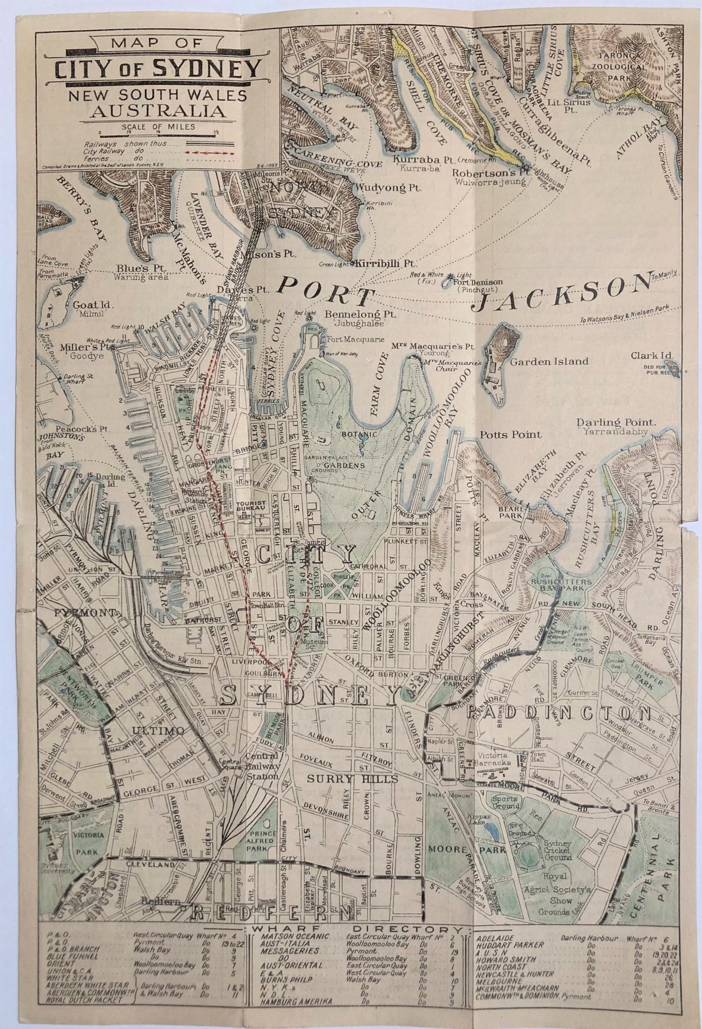
1. Printed map "Map of City of Sydney New South Wales Australia" code 34.1052, suggesting a 1934 edition not recorded on Trove or OCLC. The street map of central Sydney shows places of interest and location of wharves used by the shipping companies listed, with index. Advertisements of Tourist Bureau tours on verso. Libraries Australia ID 55363299 for a 1945 edition, 1933 edition at OCLC: 221577632 with printers code "33-644."
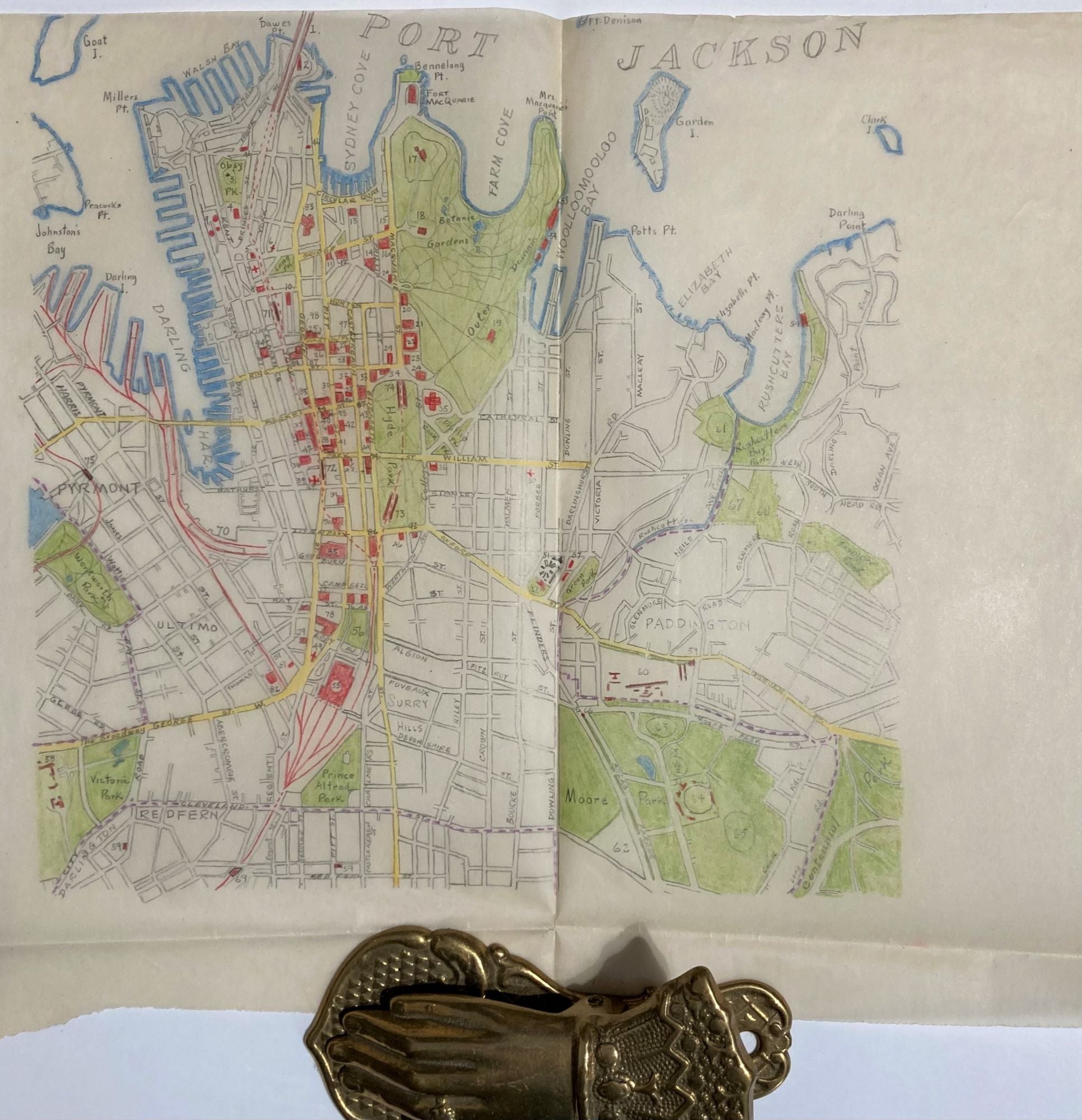
2. Detailed street map of CBD, from Redfern to Dawes Pt and Pyrmont to Centennial Park, on tracing paper, color coded. 9 x 9.5" on larger paper, folded.
3. Sketch map, 2 sheets, of the area around the Railway station, Camperdown District and Resch's Ltd. Brewery, Dowling St. connecting to the CBD all the way to Circular Quay
4 & 5. 2 sketch maps of the CBD with locations keyed in, and another larger scale. Paper 7x8.5"
6. Sketched outline map in pencil, 14 x 18, large scale on cream paper;
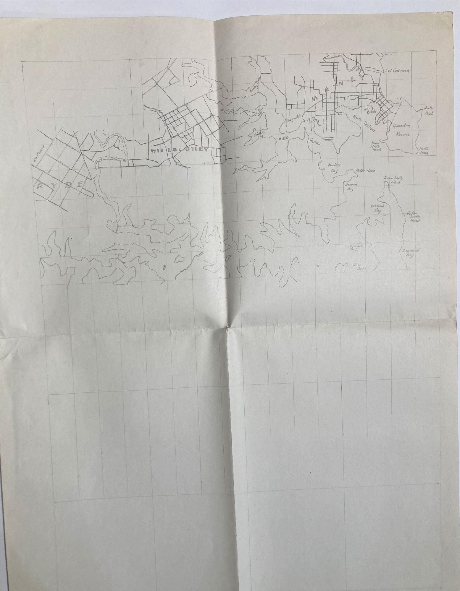
7. Detailed map, 5 x 7.5" on larger tracing paper, detailed, color, with a scale, from Manly to Botany Bay and Burward to Waverley. With population figures for 1901 and 1930.
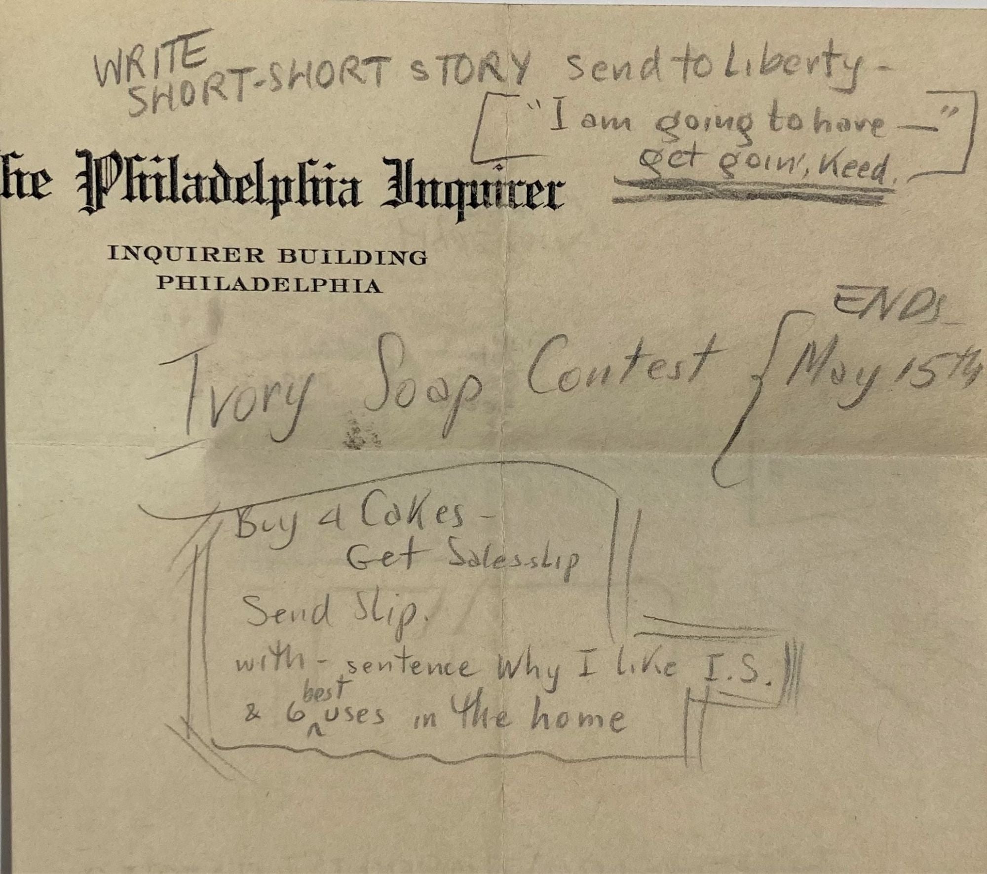
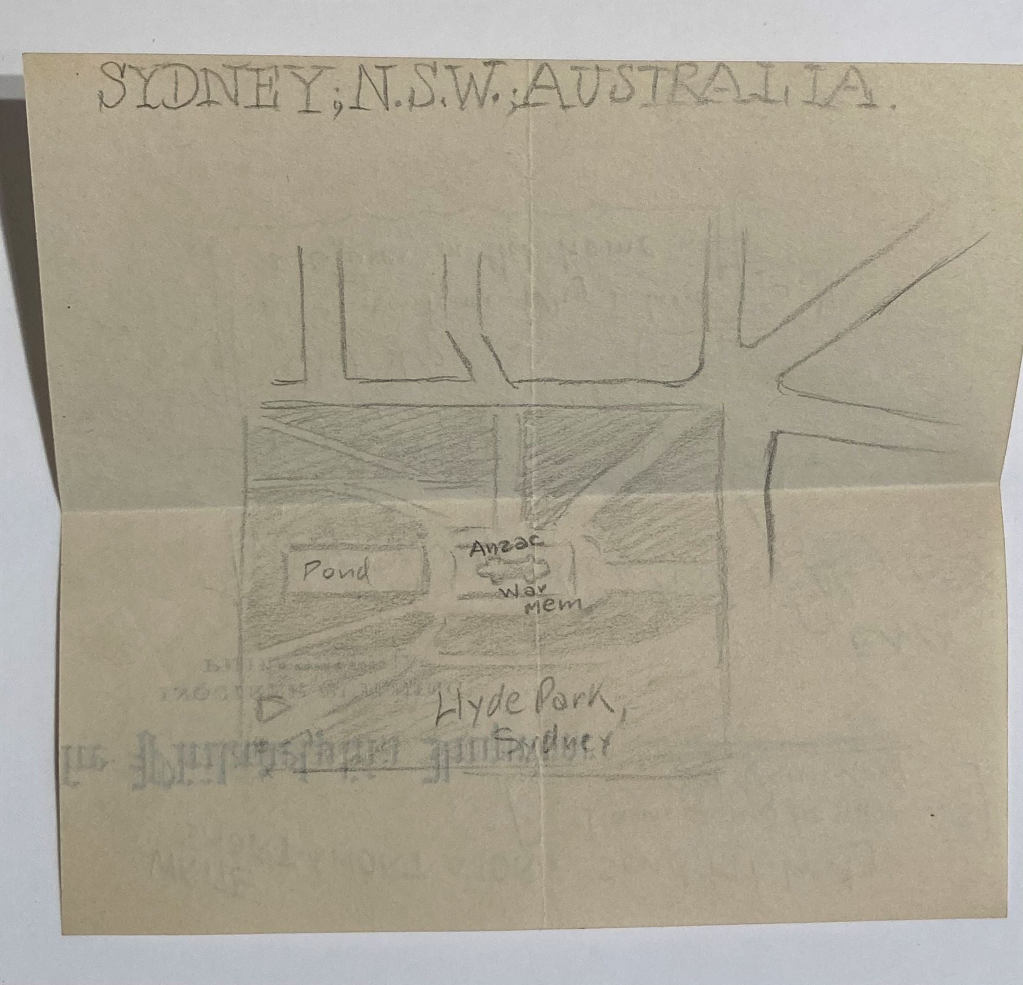
8. A small map of Hyde Park, Sydney is sketched on the verso of a fragment of letterhead from The Philadelphia Inquirer, along with these notes to Self- "Write Short-Short Story send to Liberty (Magazine)- "I am going to have - " get goin', keed."
Ivory Soap Contest ENDS May 15th. Buy 4 Cokes, get sales slip, send slip with sentence Why I like I.S. & 6 best uses in the home." Paper 5 3/4 x 4 1/4".
MELBOURNE - 2 pp handwritten including Banks (13); Clubs (9); Newspapers- Argus, Age, Sun in the morning and the Herald in the evening; Racecourses (with the distance from the GPO) (6); Theatres- Stage (4) and Cinemas (7); 1 tourist Bureau, Churches (12) including all in Sydney with the exception of Seventh Day & Unitarians.
1. Printed map, "Victorian Railways map of Melbourne and suburbs : Flinders Street Station, the gateway of the metropolis", pictorial map colored, 38 x 34 cm., folded to 19 x 8 cm, "1st Jany 1934", Libraries Australia ID 26756285;
2. Sketch map on tracing paper, Royal Park to Albert Park and Port Melbourne to Orron(g) Rd. Detailed but not indexed. Blocks inked in.
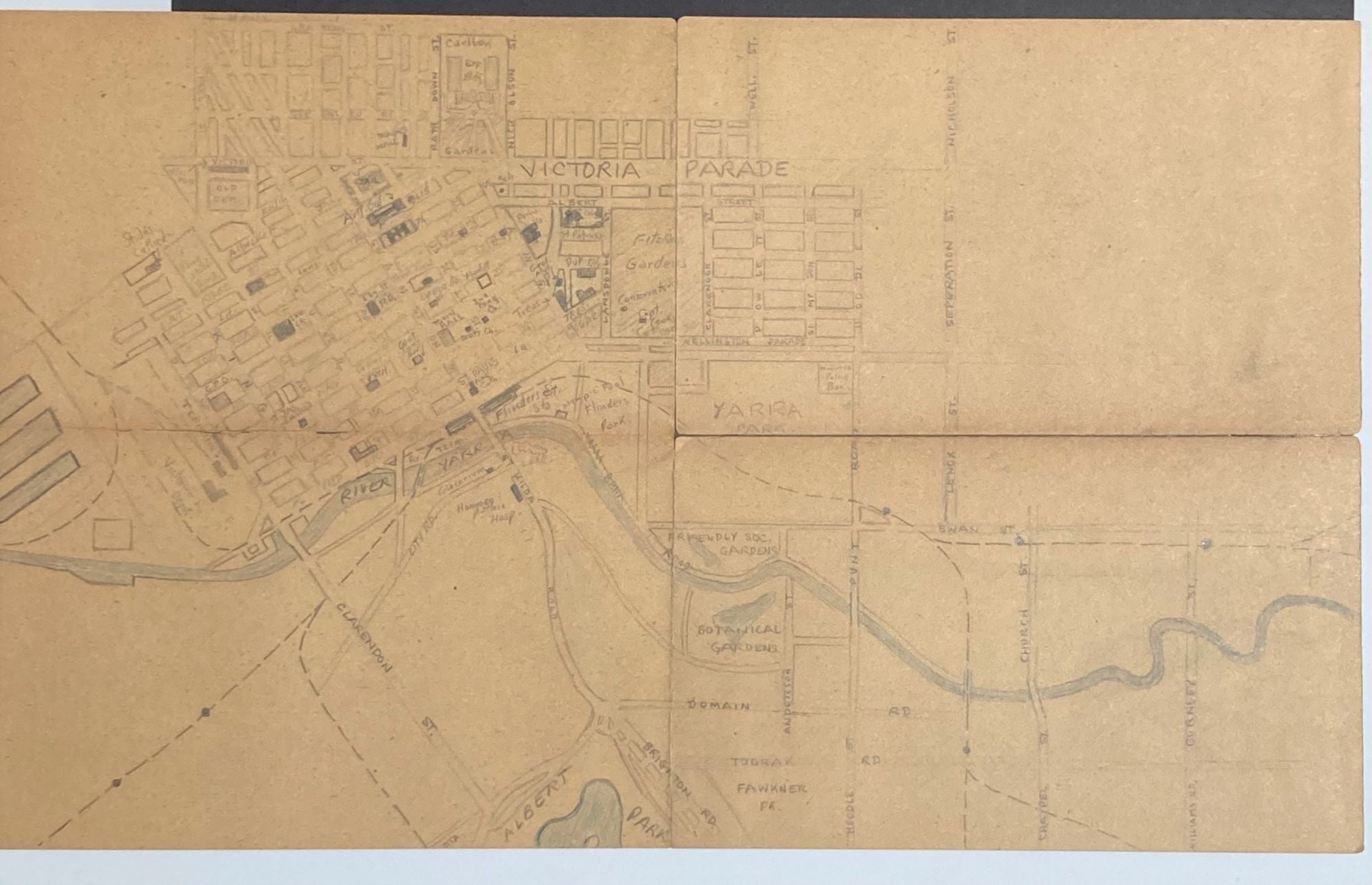
3. Sketch map with color, 14 x 8.5", showing either side of the Yarra , essentially CBD to northern edge of Carlton Gardens down to Albert Park and from the port to beyond Burnley St. folded, one quadrant repaired with acid free tape;
4. Sketch map, overview of Melbourne from Royal Park to Port Phillip, Footscray to St. Kilda. 7x8.5" Item #26963
Price: $650.00